You are here: Home > Network List > TA - USArray Transportable Network (new EarthScope stations) Stations List
> Station L19K White Mountain, AK, USA > Earthquake Result Viewer
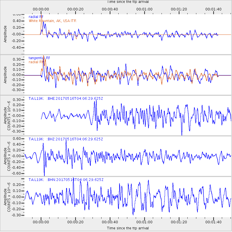
L19K White Mountain, AK, USA - Earthquake Result Viewer
*The percent match for this event was below the threshold and hence no stack was calculated.
| Earthquake location: |
South Of Mariana Islands |
| Earthquake latitude/longitude: |
12.4/145.1 |
| Earthquake time(UTC): |
2017/05/16 (136) 03:56:22 GMT |
| Earthquake Depth: |
40 km |
| Earthquake Magnitude: |
5.5 Mi |
| Earthquake Catalog/Contributor: |
NEIC PDE/pt |
|
| Network: |
TA USArray Transportable Network (new EarthScope stations) |
| Station: |
L19K White Mountain, AK, USA |
| Lat/Lon: |
62.18 N/154.85 W |
| Elevation: |
650 m |
|
| Distance: |
65.3 deg |
| Az: |
26.554 deg |
| Baz: |
248.603 deg |
| Ray Param: |
$rayparam |
*The percent match for this event was below the threshold and hence was not used in the summary stack. |
|
| Radial Match: |
63.856186 % |
| Radial Bump: |
400 |
| Transverse Match: |
65.79474 % |
| Transverse Bump: |
400 |
| SOD ConfigId: |
13570011 |
| Insert Time: |
2019-04-28 01:24:11.048 +0000 |
| GWidth: |
2.5 |
| Max Bumps: |
400 |
| Tol: |
0.001 |
|
Signal To Noise
| Channel | StoN | STA | LTA |
| TA:L19K: :BHZ:20170516T04:06:29.625Z | 4.6459646 | 2.394056E-7 | 5.1529796E-8 |
| TA:L19K: :BHN:20170516T04:06:29.625Z | 0.8447425 | 6.05971E-8 | 7.1734405E-8 |
| TA:L19K: :BHE:20170516T04:06:29.625Z | 3.5616777 | 1.473864E-7 | 4.1381174E-8 |
| Arrivals |
| Ps | |
| PpPs | |
| PsPs/PpSs | |


