You are here: Home > Network List > TJ - Tajikistan National Seismic Network Stations List
> Station GARM Garm, Tajikistan > Earthquake Result Viewer
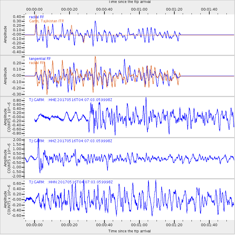
GARM Garm, Tajikistan - Earthquake Result Viewer
*The percent match for this event was below the threshold and hence no stack was calculated.
| Earthquake location: |
South Of Mariana Islands |
| Earthquake latitude/longitude: |
12.4/145.1 |
| Earthquake time(UTC): |
2017/05/16 (136) 03:56:22 GMT |
| Earthquake Depth: |
40 km |
| Earthquake Magnitude: |
5.5 Mi |
| Earthquake Catalog/Contributor: |
NEIC PDE/pt |
|
| Network: |
TJ Tajikistan National Seismic Network |
| Station: |
GARM Garm, Tajikistan |
| Lat/Lon: |
39.00 N/70.32 E |
| Elevation: |
1305 m |
|
| Distance: |
70.6 deg |
| Az: |
307.11 deg |
| Baz: |
89.658 deg |
| Ray Param: |
$rayparam |
*The percent match for this event was below the threshold and hence was not used in the summary stack. |
|
| Radial Match: |
75.489174 % |
| Radial Bump: |
400 |
| Transverse Match: |
70.42293 % |
| Transverse Bump: |
400 |
| SOD ConfigId: |
13570011 |
| Insert Time: |
2019-04-28 01:24:32.656 +0000 |
| GWidth: |
2.5 |
| Max Bumps: |
400 |
| Tol: |
0.001 |
|
Signal To Noise
| Channel | StoN | STA | LTA |
| TJ:GARM: :HHZ:20170516T04:07:03.059998Z | 10.023061 | 8.313282E-7 | 8.294154E-8 |
| TJ:GARM: :HHN:20170516T04:07:03.059998Z | 1.6737429 | 1.3591765E-7 | 8.120581E-8 |
| TJ:GARM: :HHE:20170516T04:07:03.059998Z | 3.0488107 | 3.2790933E-7 | 1.0755319E-7 |
| Arrivals |
| Ps | |
| PpPs | |
| PsPs/PpSs | |


