You are here: Home > Network List > TA - USArray Transportable Network (new EarthScope stations) Stations List
> Station P17K Kvichak River, AK, USA > Earthquake Result Viewer
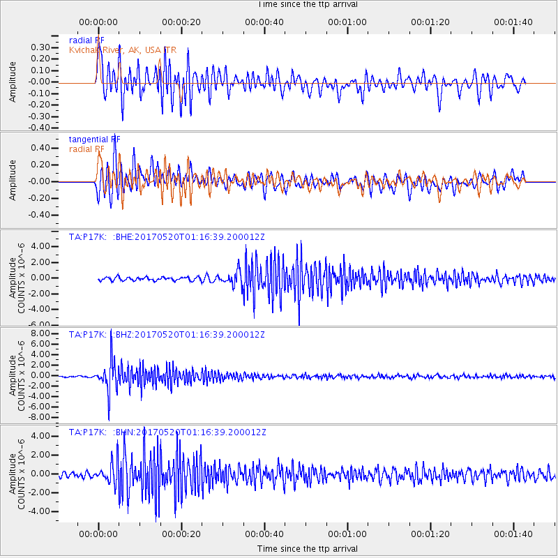
P17K Kvichak River, AK, USA - Earthquake Result Viewer
*The percent match for this event was below the threshold and hence no stack was calculated.
| Earthquake location: |
Negros, Philippines |
| Earthquake latitude/longitude: |
9.4/124.0 |
| Earthquake time(UTC): |
2017/05/20 (140) 01:06:13 GMT |
| Earthquake Depth: |
521 km |
| Earthquake Magnitude: |
5.9 Mww |
| Earthquake Catalog/Contributor: |
NEIC PDE/us |
|
| Network: |
TA USArray Transportable Network (new EarthScope stations) |
| Station: |
P17K Kvichak River, AK, USA |
| Lat/Lon: |
59.20 N/156.44 W |
| Elevation: |
91 m |
|
| Distance: |
76.7 deg |
| Az: |
31.347 deg |
| Baz: |
265.899 deg |
| Ray Param: |
$rayparam |
*The percent match for this event was below the threshold and hence was not used in the summary stack. |
|
| Radial Match: |
78.87599 % |
| Radial Bump: |
400 |
| Transverse Match: |
80.97766 % |
| Transverse Bump: |
400 |
| SOD ConfigId: |
13570011 |
| Insert Time: |
2019-04-28 01:30:29.703 +0000 |
| GWidth: |
2.5 |
| Max Bumps: |
400 |
| Tol: |
0.001 |
|
Signal To Noise
| Channel | StoN | STA | LTA |
| TA:P17K: :BHZ:20170520T01:16:39.200012Z | 24.657253 | 2.9632927E-6 | 1.2017935E-7 |
| TA:P17K: :BHN:20170520T01:16:39.200012Z | 5.8997436 | 1.1263412E-6 | 1.909136E-7 |
| TA:P17K: :BHE:20170520T01:16:39.200012Z | 4.113126 | 8.621736E-7 | 2.0961518E-7 |
| Arrivals |
| Ps | |
| PpPs | |
| PsPs/PpSs | |


