
431A Sonora, TX, USA - Earthquake Result Viewer
| ||||||||||||||||||
| ||||||||||||||||||
| ||||||||||||||||||
|
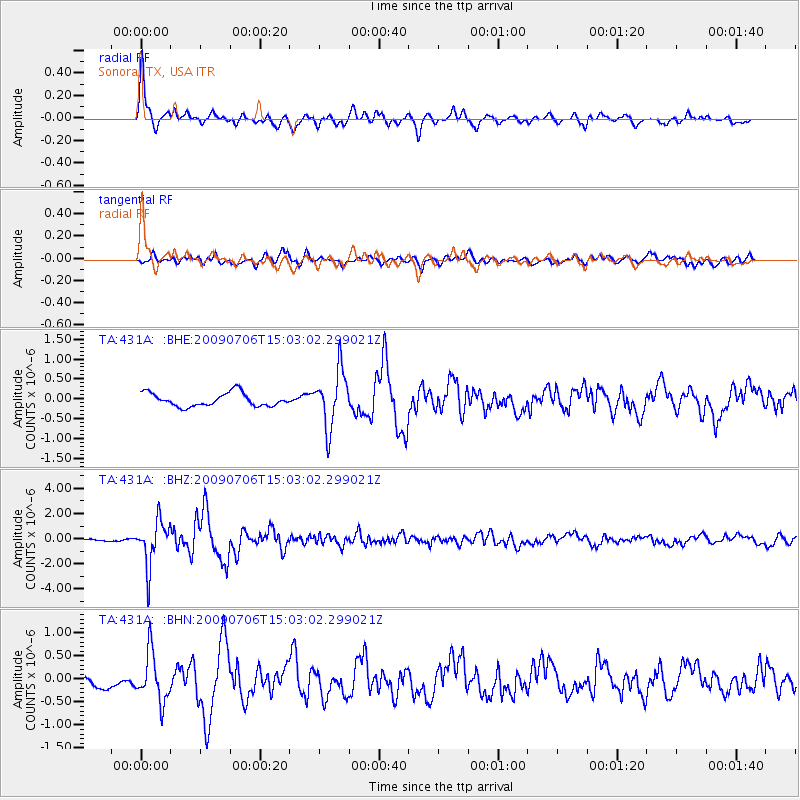
Signal To Noise
| Channel | StoN | STA | LTA |
| TA:431A: :BHZ:20090706T15:03:02.299021Z | 16.635546 | 1.7837192E-6 | 1.0722336E-7 |
| TA:431A: :BHN:20090706T15:03:02.299021Z | 2.3666103 | 5.3066435E-7 | 2.2422972E-7 |
| TA:431A: :BHE:20090706T15:03:02.299021Z | 4.2843175 | 7.171327E-7 | 1.6738552E-7 |
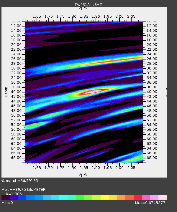
| Arrivals | |
| Ps | 5.7 SECOND |
| PpPs | 17 SECOND |
| PsPs/PpSs | 23 SECOND |

