
431A Sonora, TX, USA - Earthquake Result Viewer
| ||||||||||||||||||
| ||||||||||||||||||
| ||||||||||||||||||
|
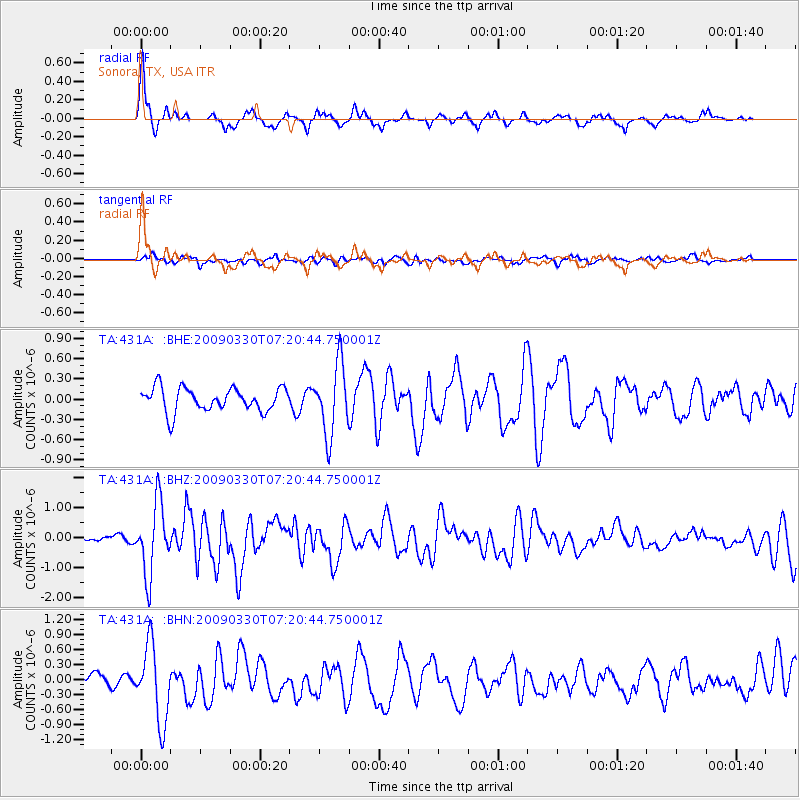
Signal To Noise
| Channel | StoN | STA | LTA |
| TA:431A: :BHZ:20090330T07:20:44.750001Z | 6.773661 | 1.1747605E-6 | 1.7343066E-7 |
| TA:431A: :BHN:20090330T07:20:44.750001Z | 5.4060054 | 7.6450635E-7 | 1.4141797E-7 |
| TA:431A: :BHE:20090330T07:20:44.750001Z | 2.9920228 | 5.225051E-7 | 1.7463272E-7 |
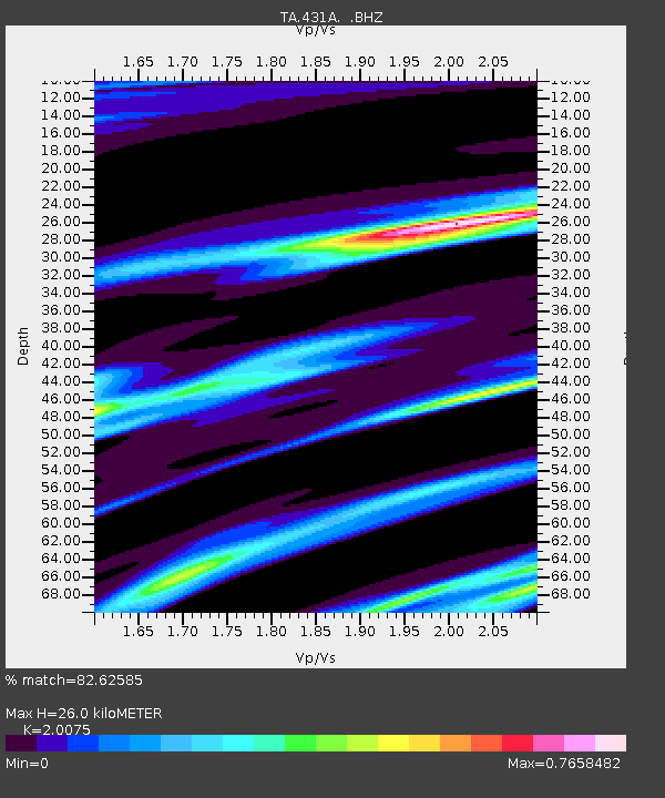
| Arrivals | |
| Ps | 4.3 SECOND |
| PpPs | 12 SECOND |
| PsPs/PpSs | 16 SECOND |

