You are here: Home > Network List > TA - USArray Transportable Network (new EarthScope stations) Stations List
> Station 431A Sonora, TX, USA > Earthquake Result Viewer
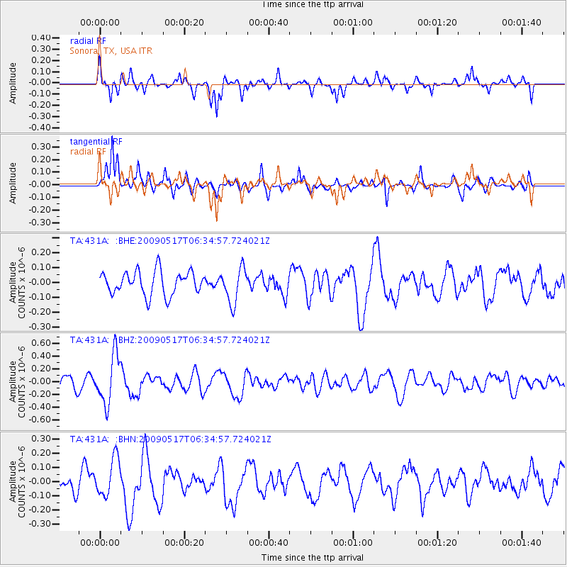
431A Sonora, TX, USA - Earthquake Result Viewer
*The percent match for this event was below the threshold and hence no stack was calculated.
| Earthquake location: |
Tonga Islands |
| Earthquake latitude/longitude: |
-16.8/-173.5 |
| Earthquake time(UTC): |
2009/05/17 (137) 06:23:03 GMT |
| Earthquake Depth: |
67 km |
| Earthquake Magnitude: |
5.5 MB, 5.6 MW, 5.6 MW |
| Earthquake Catalog/Contributor: |
WHDF/NEIC |
|
| Network: |
TA USArray Transportable Network (new EarthScope stations) |
| Station: |
431A Sonora, TX, USA |
| Lat/Lon: |
30.68 N/100.61 W |
| Elevation: |
700 m |
|
| Distance: |
84.4 deg |
| Az: |
55.815 deg |
| Baz: |
246.871 deg |
| Ray Param: |
$rayparam |
*The percent match for this event was below the threshold and hence was not used in the summary stack. |
|
| Radial Match: |
72.25312 % |
| Radial Bump: |
352 |
| Transverse Match: |
71.052635 % |
| Transverse Bump: |
392 |
| SOD ConfigId: |
2760 |
| Insert Time: |
2010-03-05 23:57:46.205 +0000 |
| GWidth: |
2.5 |
| Max Bumps: |
400 |
| Tol: |
0.001 |
|
Signal To Noise
| Channel | StoN | STA | LTA |
| TA:431A: :BHZ:20090517T06:34:57.724021Z | 4.414541 | 3.9754374E-7 | 9.005325E-8 |
| TA:431A: :BHN:20090517T06:34:57.724021Z | 2.2478046 | 1.3919718E-7 | 6.192584E-8 |
| TA:431A: :BHE:20090517T06:34:57.724021Z | 1.5417053 | 1.2227609E-7 | 7.931224E-8 |
| Arrivals |
| Ps | |
| PpPs | |
| PsPs/PpSs | |


