You are here: Home > Network List > TA - USArray Transportable Network (new EarthScope stations) Stations List
> Station 431A Sonora, TX, USA > Earthquake Result Viewer
431A Sonora, TX, USA - Earthquake Result Viewer
*The percent match for this event was below the threshold and hence no stack was calculated.
| Earthquake location: |
Samoa Islands Region |
| Earthquake latitude/longitude: |
-16.4/-172.0 |
| Earthquake time(UTC): |
2009/10/17 (290) 10:45:26 GMT |
| Earthquake Depth: |
10 km |
| Earthquake Magnitude: |
5.7 MB, 5.3 MS, 5.7 MW, 5.7 MW |
| Earthquake Catalog/Contributor: |
WHDF/NEIC |
|
| Network: |
TA USArray Transportable Network (new EarthScope stations) |
| Station: |
431A Sonora, TX, USA |
| Lat/Lon: |
30.68 N/100.61 W |
| Elevation: |
700 m |
|
| Distance: |
83.0 deg |
| Az: |
55.34 deg |
| Baz: |
246.431 deg |
| Ray Param: |
$rayparam |
*The percent match for this event was below the threshold and hence was not used in the summary stack. |
|
| Radial Match: |
52.63986 % |
| Radial Bump: |
360 |
| Transverse Match: |
75.638214 % |
| Transverse Bump: |
336 |
| SOD ConfigId: |
2622 |
| Insert Time: |
2010-03-05 23:58:04.644 +0000 |
| GWidth: |
2.5 |
| Max Bumps: |
400 |
| Tol: |
0.001 |
|
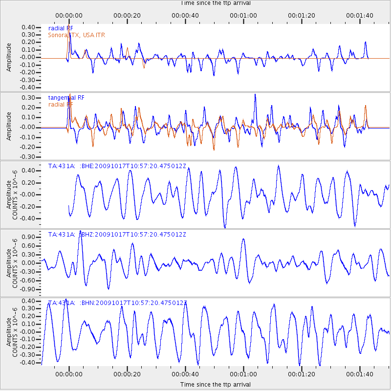
Signal To Noise
| Channel | StoN | STA | LTA |
| TA:431A: :BHZ:20091017T10:57:20.475012Z | 3.1539118 | 5.2890454E-7 | 1.6769795E-7 |
| TA:431A: :BHN:20091017T10:57:20.475012Z | 0.9378438 | 1.9885587E-7 | 2.1203516E-7 |
| TA:431A: :BHE:20091017T10:57:20.475012Z | 0.46980596 | 1.1114276E-7 | 2.3657162E-7 |
| Arrivals |
| Ps | |
| PpPs | |
| PsPs/PpSs | |


