You are here: Home > Network List > TA - USArray Transportable Network (new EarthScope stations) Stations List
> Station 431A Sonora, TX, USA > Earthquake Result Viewer
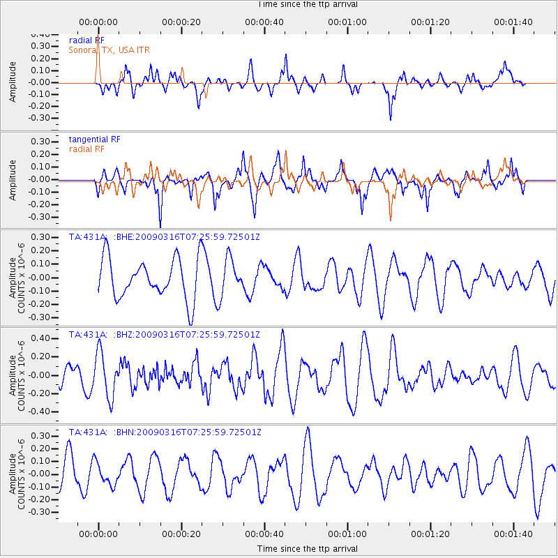
431A Sonora, TX, USA - Earthquake Result Viewer
*The percent match for this event was below the threshold and hence no stack was calculated.
| Earthquake location: |
Pacific-Antarctic Ridge |
| Earthquake latitude/longitude: |
-55.1/-129.7 |
| Earthquake time(UTC): |
2009/03/16 (075) 07:13:36 GMT |
| Earthquake Depth: |
10 km |
| Earthquake Magnitude: |
5.9 MW, 5.2 MS, 5.1 MB, 5.9 MW |
| Earthquake Catalog/Contributor: |
WHDF/NEIC |
|
| Network: |
TA USArray Transportable Network (new EarthScope stations) |
| Station: |
431A Sonora, TX, USA |
| Lat/Lon: |
30.68 N/100.61 W |
| Elevation: |
700 m |
|
| Distance: |
89.1 deg |
| Az: |
24.767 deg |
| Baz: |
196.211 deg |
| Ray Param: |
$rayparam |
*The percent match for this event was below the threshold and hence was not used in the summary stack. |
|
| Radial Match: |
53.868458 % |
| Radial Bump: |
400 |
| Transverse Match: |
62.584377 % |
| Transverse Bump: |
400 |
| SOD ConfigId: |
2658 |
| Insert Time: |
2010-03-05 23:58:18.841 +0000 |
| GWidth: |
2.5 |
| Max Bumps: |
400 |
| Tol: |
0.001 |
|
Signal To Noise
| Channel | StoN | STA | LTA |
| TA:431A: :BHZ:20090316T07:25:59.72501Z | 3.4317448 | 2.4754462E-7 | 7.2133744E-8 |
| TA:431A: :BHN:20090316T07:25:59.72501Z | 0.70766634 | 8.370309E-8 | 1.18280454E-7 |
| TA:431A: :BHE:20090316T07:25:59.72501Z | 0.90098816 | 1.3435037E-7 | 1.4911447E-7 |
| Arrivals |
| Ps | |
| PpPs | |
| PsPs/PpSs | |


