T22A Edith, CO, USA - Earthquake Result Viewer
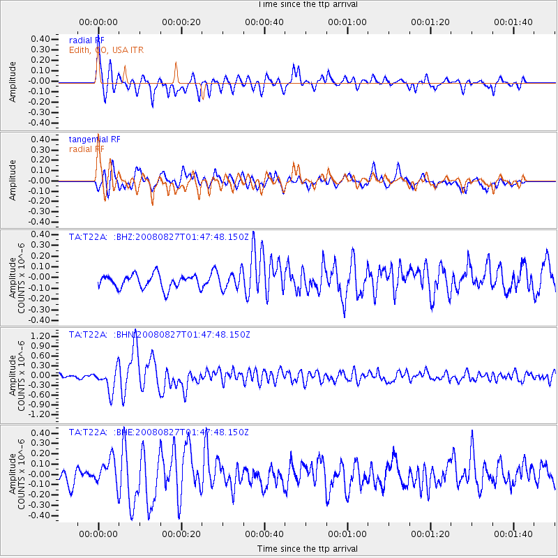
Earthquake location: Lake Baykal Region, Russia
Earthquake latitude/longitude: 51.6/104.2
Earthquake time(UTC): 2008/08/27 (240) 01:35:32 GMT
Earthquake Depth: 16 km
Earthquake Magnitude: 5.8 MB, 6.2 MS, 6.2 MW, 6.2 MW
Earthquake Catalog/Contributor: WHDF/NEIC
Network: TA USArray Transportable Network (new EarthScope stations)
Station: T22A Edith, CO, USA
Lat/Lon: 37.01 N/106.90 W
Elevation: 2224 m
Distance: 87.6 deg
Az: 24.414 deg
Baz: 341.215 deg
Ray Param: 0.043162026
Estimated Moho Depth: 24.75 km
Estimated Crust Vp/Vs: 1.66
Assumed Crust Vp: 6.159 km/s
Estimated Crust Vs: 3.704 km/s
Estimated Crust Poisson's Ratio: 0.22
Radial Match: 85.43197 %
Radial Bump: 400
Transverse Match: 71.73685 %
Transverse Bump: 400
SOD ConfigId: 2504
Insert Time: 2010-03-05 23:59:03.595 +0000
GWidth: 2.5
Max Bumps: 400
Tol: 0.001

Signal To Noise

ChannelStoNSTALTA
TA:T22A: :BHN:20080827T01:47:48.150Z5.29389333.7245738E-77.035604E-8
TA:T22A: :BHE:20080827T01:47:48.150Z2.2186711.3820902E-76.22936E-8
TA:T22A: :BHZ:20080827T01:47:48.150Z1.23436947.748852E-86.27758E-8
Arrivals
Ps2.7 SECOND
PpPs10 SECOND
PsPs/PpSs13 SECOND