You are here: Home > Network List > UW - Pacific Northwest Regional Seismic Network Stations List
> Station MRBL Marblemount, WA, USA > Earthquake Result Viewer
MRBL Marblemount, WA, USA - Earthquake Result Viewer
*The percent match for this event was below the threshold and hence no stack was calculated.
| Earthquake location: |
Off Coast Of Jalisco, Mexico |
| Earthquake latitude/longitude: |
17.4/-105.4 |
| Earthquake time(UTC): |
2017/05/20 (140) 06:02:13 GMT |
| Earthquake Depth: |
10 km |
| Earthquake Magnitude: |
5.8 Mww |
| Earthquake Catalog/Contributor: |
NEIC PDE/us |
|
| Network: |
UW Pacific Northwest Regional Seismic Network |
| Station: |
MRBL Marblemount, WA, USA |
| Lat/Lon: |
48.52 N/121.48 W |
| Elevation: |
75 m |
|
| Distance: |
33.7 deg |
| Az: |
340.557 deg |
| Baz: |
151.449 deg |
| Ray Param: |
$rayparam |
*The percent match for this event was below the threshold and hence was not used in the summary stack. |
|
| Radial Match: |
69.18591 % |
| Radial Bump: |
400 |
| Transverse Match: |
43.709885 % |
| Transverse Bump: |
400 |
| SOD ConfigId: |
13570011 |
| Insert Time: |
2019-04-28 01:38:10.304 +0000 |
| GWidth: |
2.5 |
| Max Bumps: |
400 |
| Tol: |
0.001 |
|
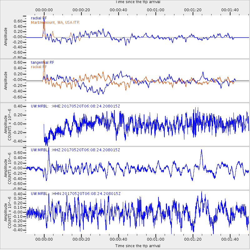
Signal To Noise
| Channel | StoN | STA | LTA |
| UW:MRBL: :HHZ:20170520T06:08:24.208015Z | 5.5676913 | 2.9017005E-7 | 5.211676E-8 |
| UW:MRBL: :HHN:20170520T06:08:24.208015Z | 2.3211982 | 1.6069295E-7 | 6.922844E-8 |
| UW:MRBL: :HHE:20170520T06:08:24.208015Z | 1.2429782 | 1.9090658E-7 | 1.5358803E-7 |
| Arrivals |
| Ps | |
| PpPs | |
| PsPs/PpSs | |


