
T22A Edith, CO, USA - Earthquake Result Viewer
| ||||||||||||||||||
| ||||||||||||||||||
| ||||||||||||||||||
|
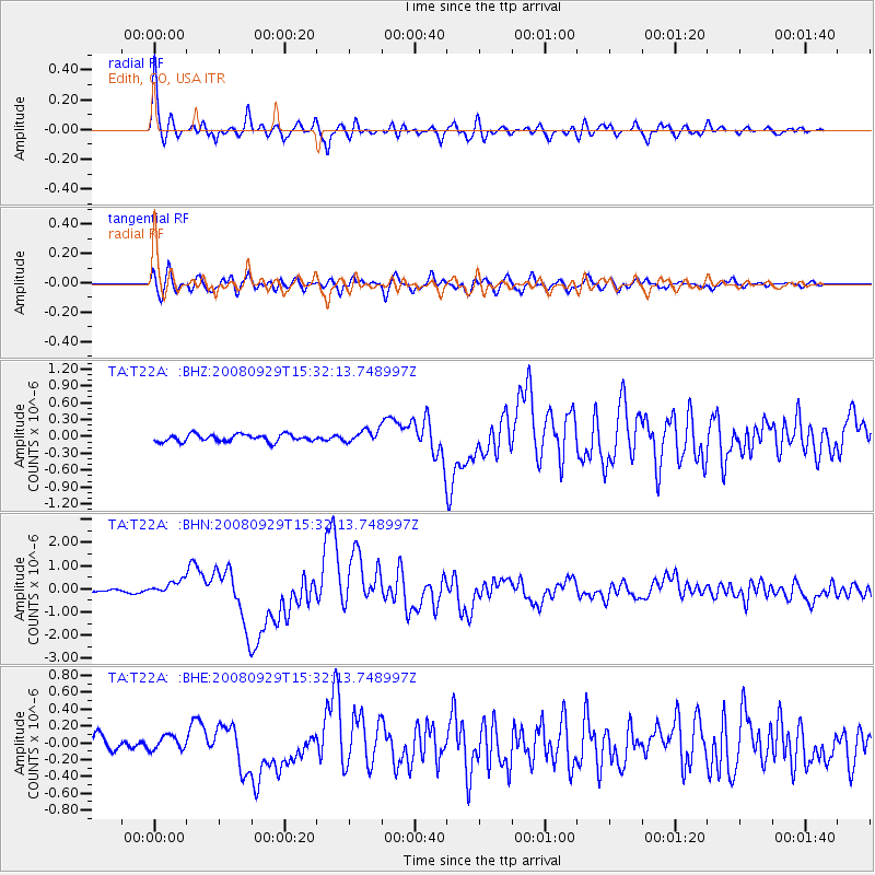
Signal To Noise
| Channel | StoN | STA | LTA |
| TA:T22A: :BHN:20080929T15:32:13.748997Z | 4.798243 | 3.1090516E-7 | 6.479562E-8 |
| TA:T22A: :BHE:20080929T15:32:13.748997Z | 0.9937121 | 8.401041E-8 | 8.4542E-8 |
| TA:T22A: :BHZ:20080929T15:32:13.748997Z | 1.7351518 | 1.115576E-7 | 6.4292706E-8 |
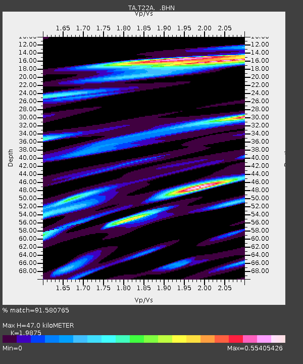
| Arrivals | |
| Ps | 7.7 SECOND |
| PpPs | 22 SECOND |
| PsPs/PpSs | 30 SECOND |

