
T22A Edith, CO, USA - Earthquake Result Viewer
| ||||||||||||||||||
| ||||||||||||||||||
| ||||||||||||||||||
|
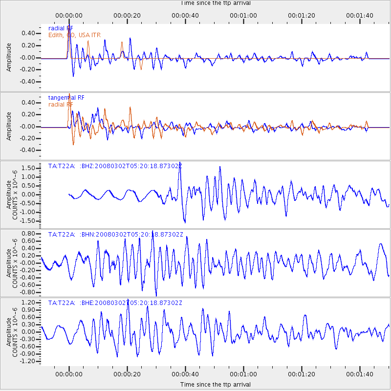
Signal To Noise
| Channel | StoN | STA | LTA |
| TA:T22A: :BHN:20080302T05:20:18.87302Z | 1.9956976 | 2.4297486E-7 | 1.2174934E-7 |
| TA:T22A: :BHE:20080302T05:20:18.87302Z | 1.8987043 | 3.2865304E-7 | 1.7309333E-7 |
| TA:T22A: :BHZ:20080302T05:20:18.87302Z | 1.3439189 | 2.5850696E-7 | 1.923531E-7 |
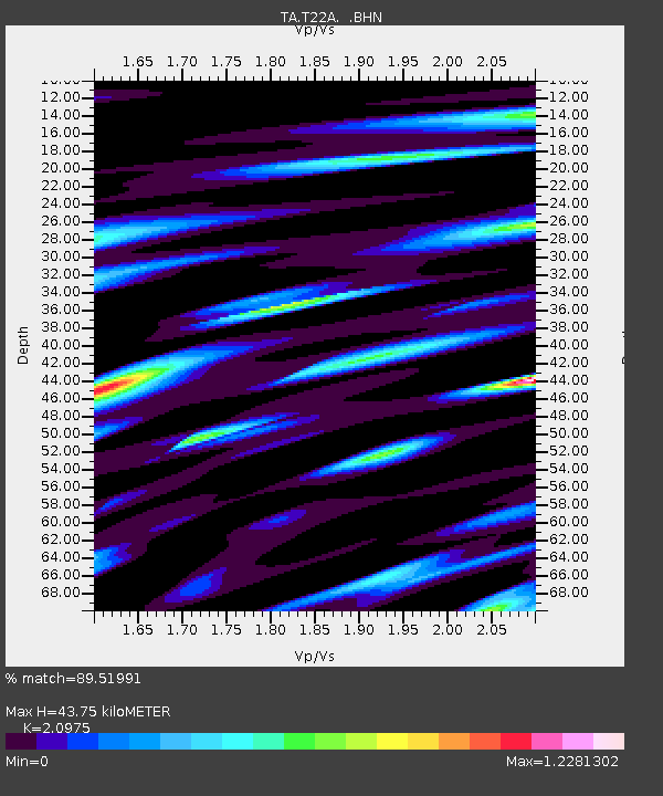
| Arrivals | |
| Ps | 8.1 SECOND |
| PpPs | 21 SECOND |
| PsPs/PpSs | 29 SECOND |

