You are here: Home > Network List > TA - USArray Transportable Network (new EarthScope stations) Stations List
> Station T22A Edith, CO, USA > Earthquake Result Viewer
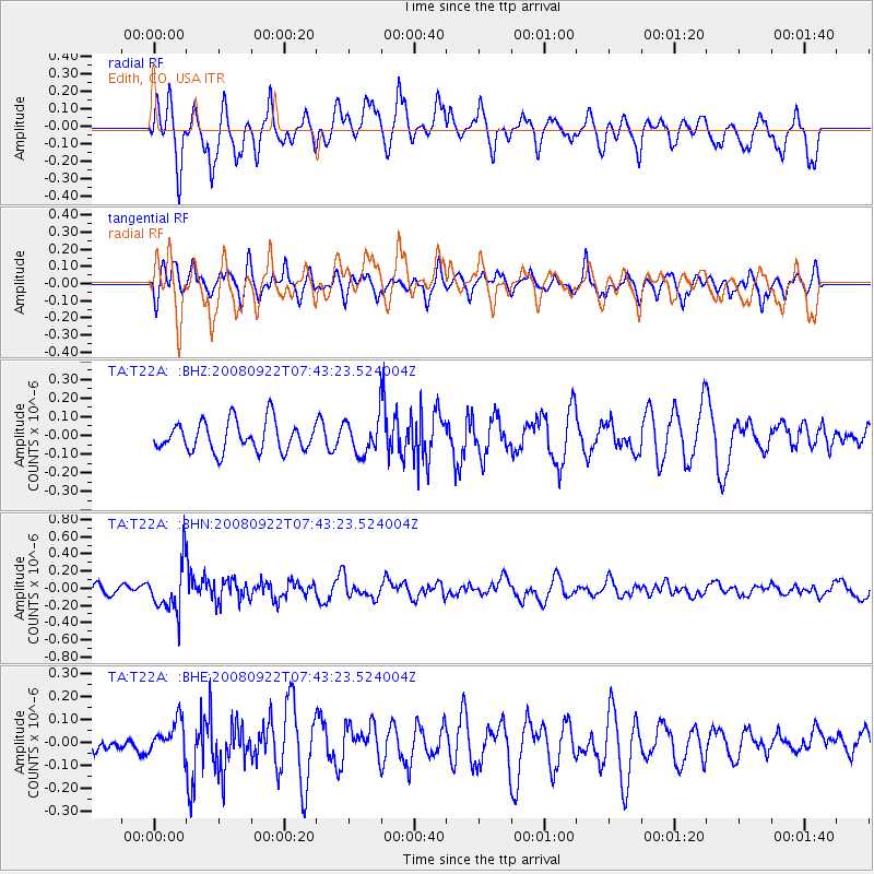
T22A Edith, CO, USA - Earthquake Result Viewer
*The percent match for this event was below the threshold and hence no stack was calculated.
| Earthquake location: |
Hokkaido, Japan Region |
| Earthquake latitude/longitude: |
41.6/140.4 |
| Earthquake time(UTC): |
2008/09/22 (266) 07:31:59 GMT |
| Earthquake Depth: |
149 km |
| Earthquake Magnitude: |
5.7 MW, 5.3 MB, 5.6 MW |
| Earthquake Catalog/Contributor: |
WHDF/NEIC |
|
| Network: |
TA USArray Transportable Network (new EarthScope stations) |
| Station: |
T22A Edith, CO, USA |
| Lat/Lon: |
37.01 N/106.90 W |
| Elevation: |
2224 m |
|
| Distance: |
80.5 deg |
| Az: |
48.503 deg |
| Baz: |
315.409 deg |
| Ray Param: |
$rayparam |
*The percent match for this event was below the threshold and hence was not used in the summary stack. |
|
| Radial Match: |
66.962036 % |
| Radial Bump: |
400 |
| Transverse Match: |
56.812176 % |
| Transverse Bump: |
394 |
| SOD ConfigId: |
2560 |
| Insert Time: |
2010-03-06 00:00:13.357 +0000 |
| GWidth: |
2.5 |
| Max Bumps: |
400 |
| Tol: |
0.001 |
|
Signal To Noise
| Channel | StoN | STA | LTA |
| TA:T22A: :BHN:20080922T07:43:23.524004Z | 4.2661686 | 2.7295778E-7 | 6.398195E-8 |
| TA:T22A: :BHE:20080922T07:43:23.524004Z | 0.7126666 | 7.380052E-8 | 1.0355547E-7 |
| TA:T22A: :BHZ:20080922T07:43:23.524004Z | 1.1930856 | 9.47393E-8 | 7.940696E-8 |
| Arrivals |
| Ps | |
| PpPs | |
| PsPs/PpSs | |


