You are here: Home > Network List > TA - USArray Transportable Network (new EarthScope stations) Stations List
> Station T22A Edith, CO, USA > Earthquake Result Viewer
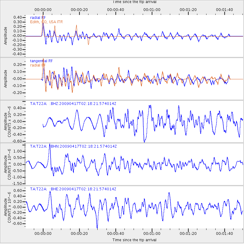
T22A Edith, CO, USA - Earthquake Result Viewer
*The percent match for this event was below the threshold and hence no stack was calculated.
| Earthquake location: |
Near Coast Of Northern Chile |
| Earthquake latitude/longitude: |
-19.6/-70.5 |
| Earthquake time(UTC): |
2009/04/17 (107) 02:08:08 GMT |
| Earthquake Depth: |
25 km |
| Earthquake Magnitude: |
5.8 MB, 5.8 MS, 6.1 MW, 6.1 MW |
| Earthquake Catalog/Contributor: |
WHDF/NEIC |
|
| Network: |
TA USArray Transportable Network (new EarthScope stations) |
| Station: |
T22A Edith, CO, USA |
| Lat/Lon: |
37.01 N/106.90 W |
| Elevation: |
2224 m |
|
| Distance: |
65.9 deg |
| Az: |
328.641 deg |
| Baz: |
142.193 deg |
| Ray Param: |
$rayparam |
*The percent match for this event was below the threshold and hence was not used in the summary stack. |
|
| Radial Match: |
56.157284 % |
| Radial Bump: |
400 |
| Transverse Match: |
59.337566 % |
| Transverse Bump: |
400 |
| SOD ConfigId: |
2658 |
| Insert Time: |
2010-03-06 00:00:23.362 +0000 |
| GWidth: |
2.5 |
| Max Bumps: |
400 |
| Tol: |
0.001 |
|
Signal To Noise
| Channel | StoN | STA | LTA |
| TA:T22A: :BHN:20090417T02:18:21.574014Z | 3.4150975 | 5.8507584E-7 | 1.7132041E-7 |
| TA:T22A: :BHE:20090417T02:18:21.574014Z | 2.8122892 | 2.429661E-7 | 8.639442E-8 |
| TA:T22A: :BHZ:20090417T02:18:21.574014Z | 1.544209 | 2.0517743E-7 | 1.3286895E-7 |
| Arrivals |
| Ps | |
| PpPs | |
| PsPs/PpSs | |


