You are here: Home > Network List > TA - USArray Transportable Network (new EarthScope stations) Stations List
> Station T22A Edith, CO, USA > Earthquake Result Viewer
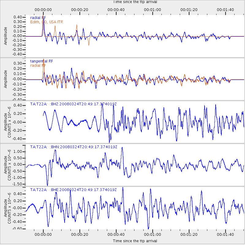
T22A Edith, CO, USA - Earthquake Result Viewer
*The percent match for this event was below the threshold and hence no stack was calculated.
| Earthquake location: |
Chile-Bolivia Border Region |
| Earthquake latitude/longitude: |
-20.0/-69.0 |
| Earthquake time(UTC): |
2008/03/24 (084) 20:39:07 GMT |
| Earthquake Depth: |
120 km |
| Earthquake Magnitude: |
5.7 MB, 6.2 MW, 6.1 MW |
| Earthquake Catalog/Contributor: |
WHDF/NEIC |
|
| Network: |
TA USArray Transportable Network (new EarthScope stations) |
| Station: |
T22A Edith, CO, USA |
| Lat/Lon: |
37.01 N/106.90 W |
| Elevation: |
2224 m |
|
| Distance: |
67.1 deg |
| Az: |
327.705 deg |
| Baz: |
141.13 deg |
| Ray Param: |
$rayparam |
*The percent match for this event was below the threshold and hence was not used in the summary stack. |
|
| Radial Match: |
67.88154 % |
| Radial Bump: |
400 |
| Transverse Match: |
69.22015 % |
| Transverse Bump: |
400 |
| SOD ConfigId: |
2504 |
| Insert Time: |
2010-03-06 00:00:26.664 +0000 |
| GWidth: |
2.5 |
| Max Bumps: |
400 |
| Tol: |
0.001 |
|
Signal To Noise
| Channel | StoN | STA | LTA |
| TA:T22A: :BHN:20080324T20:49:17.374019Z | 7.0256886 | 6.230341E-7 | 8.8679435E-8 |
| TA:T22A: :BHE:20080324T20:49:17.374019Z | 1.8407471 | 2.3458149E-7 | 1.274382E-7 |
| TA:T22A: :BHZ:20080324T20:49:17.374019Z | 1.6550351 | 1.9806221E-7 | 1.196725E-7 |
| Arrivals |
| Ps | |
| PpPs | |
| PsPs/PpSs | |


