You are here: Home > Network List > UW - Pacific Northwest Regional Seismic Network Stations List
> Station MRBL Marblemount, WA, USA > Earthquake Result Viewer
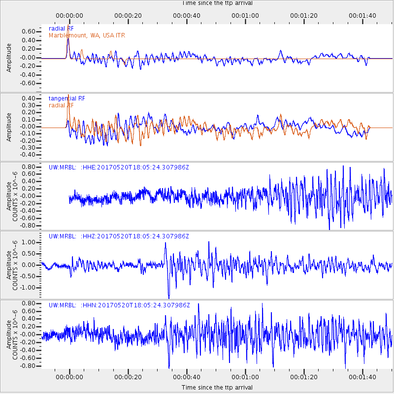
MRBL Marblemount, WA, USA - Earthquake Result Viewer
*The percent match for this event was below the threshold and hence no stack was calculated.
| Earthquake location: |
Chiapas, Mexico |
| Earthquake latitude/longitude: |
17.1/-94.0 |
| Earthquake time(UTC): |
2017/05/20 (140) 17:58:46 GMT |
| Earthquake Depth: |
144 km |
| Earthquake Magnitude: |
5.7 Mww |
| Earthquake Catalog/Contributor: |
NEIC PDE/us |
|
| Network: |
UW Pacific Northwest Regional Seismic Network |
| Station: |
MRBL Marblemount, WA, USA |
| Lat/Lon: |
48.52 N/121.48 W |
| Elevation: |
75 m |
|
| Distance: |
38.5 deg |
| Az: |
330.466 deg |
| Baz: |
134.85 deg |
| Ray Param: |
$rayparam |
*The percent match for this event was below the threshold and hence was not used in the summary stack. |
|
| Radial Match: |
75.49598 % |
| Radial Bump: |
400 |
| Transverse Match: |
67.29425 % |
| Transverse Bump: |
400 |
| SOD ConfigId: |
13570011 |
| Insert Time: |
2019-04-28 01:45:02.006 +0000 |
| GWidth: |
2.5 |
| Max Bumps: |
400 |
| Tol: |
0.001 |
|
Signal To Noise
| Channel | StoN | STA | LTA |
| UW:MRBL: :HHZ:20170520T18:05:24.307986Z | 2.5270252 | 2.0276705E-7 | 8.023943E-8 |
| UW:MRBL: :HHN:20170520T18:05:24.307986Z | 1.9527253 | 1.5511814E-7 | 7.9436745E-8 |
| UW:MRBL: :HHE:20170520T18:05:24.307986Z | 1.6463416 | 1.5152982E-7 | 9.204033E-8 |
| Arrivals |
| Ps | |
| PpPs | |
| PsPs/PpSs | |


