You are here: Home > Network List > TA - USArray Transportable Network (new EarthScope stations) Stations List
> Station T22A Edith, CO, USA > Earthquake Result Viewer
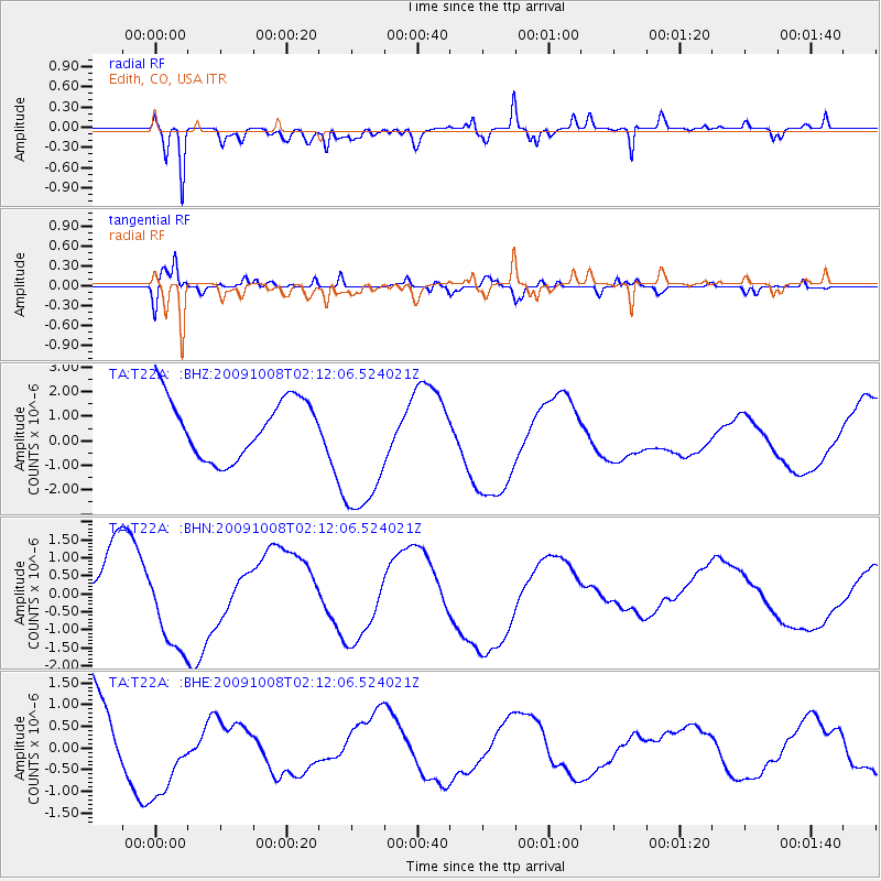
T22A Edith, CO, USA - Earthquake Result Viewer
*The percent match for this event was below the threshold and hence no stack was calculated.
| Earthquake location: |
Santa Cruz Islands |
| Earthquake latitude/longitude: |
-11.9/166.0 |
| Earthquake time(UTC): |
2009/10/08 (281) 01:59:19 GMT |
| Earthquake Depth: |
35 km |
| Earthquake Magnitude: |
5.9 MB |
| Earthquake Catalog/Contributor: |
WHDF/NEIC |
|
| Network: |
TA USArray Transportable Network (new EarthScope stations) |
| Station: |
T22A Edith, CO, USA |
| Lat/Lon: |
37.01 N/106.90 W |
| Elevation: |
2224 m |
|
| Distance: |
94.8 deg |
| Az: |
53.345 deg |
| Baz: |
258.817 deg |
| Ray Param: |
$rayparam |
*The percent match for this event was below the threshold and hence was not used in the summary stack. |
|
| Radial Match: |
60.682358 % |
| Radial Bump: |
400 |
| Transverse Match: |
42.609543 % |
| Transverse Bump: |
400 |
| SOD ConfigId: |
2622 |
| Insert Time: |
2010-03-06 00:01:11.329 +0000 |
| GWidth: |
2.5 |
| Max Bumps: |
400 |
| Tol: |
0.001 |
|
Signal To Noise
| Channel | StoN | STA | LTA |
| TA:T22A: :BHN:20091008T02:12:06.524021Z | 1.727493 | 1.2515753E-6 | 7.245038E-7 |
| TA:T22A: :BHE:20091008T02:12:06.524021Z | 0.82960546 | 1.2329317E-6 | 1.4861664E-6 |
| TA:T22A: :BHZ:20091008T02:12:06.524021Z | 2.4430103 | 2.9286548E-6 | 1.1987894E-6 |
| Arrivals |
| Ps | |
| PpPs | |
| PsPs/PpSs | |


