You are here: Home > Network List > AV - Alaska Volcano Observatory Stations List
> Station SPCR Ckakachatna River, Mount Spurr, Alaska > Earthquake Result Viewer
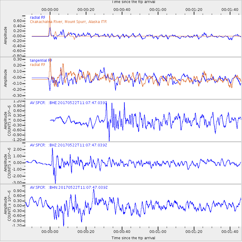
SPCR Ckakachatna River, Mount Spurr, Alaska - Earthquake Result Viewer
*The percent match for this event was below the threshold and hence no stack was calculated.
| Earthquake location: |
Kuril Islands |
| Earthquake latitude/longitude: |
43.9/147.7 |
| Earthquake time(UTC): |
2017/05/22 (142) 11:00:57 GMT |
| Earthquake Depth: |
54 km |
| Earthquake Magnitude: |
5.5 Mww |
| Earthquake Catalog/Contributor: |
NEIC PDE/us |
|
| Network: |
AV Alaska Volcano Observatory |
| Station: |
SPCR Ckakachatna River, Mount Spurr, Alaska |
| Lat/Lon: |
61.20 N/152.21 W |
| Elevation: |
984 m |
|
| Distance: |
38.8 deg |
| Az: |
42.054 deg |
| Baz: |
271.767 deg |
| Ray Param: |
$rayparam |
*The percent match for this event was below the threshold and hence was not used in the summary stack. |
|
| Radial Match: |
60.353954 % |
| Radial Bump: |
400 |
| Transverse Match: |
45.068935 % |
| Transverse Bump: |
400 |
| SOD ConfigId: |
13570011 |
| Insert Time: |
2019-04-28 01:47:11.667 +0000 |
| GWidth: |
2.5 |
| Max Bumps: |
400 |
| Tol: |
0.001 |
|
Signal To Noise
| Channel | StoN | STA | LTA |
| AV:SPCR: :BHZ:20170522T11:07:47.039Z | 4.6098733 | 1.2227653E-6 | 2.652492E-7 |
| AV:SPCR: :BHN:20170522T11:07:47.039Z | 1.4708774 | 3.8594283E-7 | 2.6238953E-7 |
| AV:SPCR: :BHE:20170522T11:07:47.039Z | 3.1323488 | 5.3397565E-7 | 1.7047134E-7 |
| Arrivals |
| Ps | |
| PpPs | |
| PsPs/PpSs | |


