You are here: Home > Network List > TA - USArray Transportable Network (new EarthScope stations) Stations List
> Station T22A Edith, CO, USA > Earthquake Result Viewer
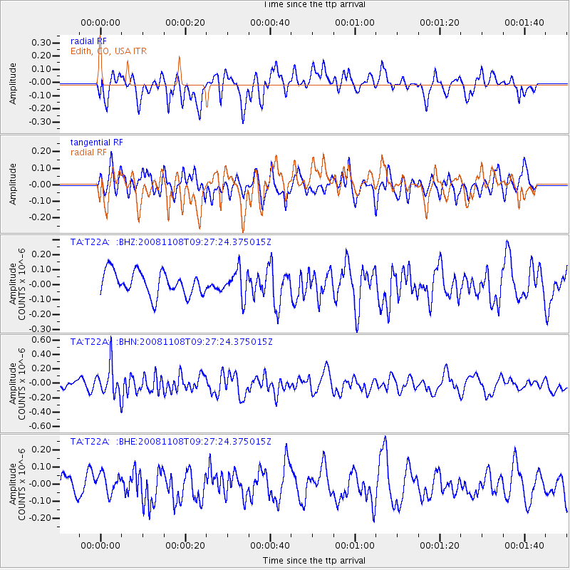
T22A Edith, CO, USA - Earthquake Result Viewer
*The percent match for this event was below the threshold and hence no stack was calculated.
| Earthquake location: |
Tonga Islands |
| Earthquake latitude/longitude: |
-15.2/-174.2 |
| Earthquake time(UTC): |
2008/11/08 (313) 09:15:51 GMT |
| Earthquake Depth: |
140 km |
| Earthquake Magnitude: |
5.5 MW, 5.3 MB |
| Earthquake Catalog/Contributor: |
WHDF/NEIC |
|
| Network: |
TA USArray Transportable Network (new EarthScope stations) |
| Station: |
T22A Edith, CO, USA |
| Lat/Lon: |
37.01 N/106.90 W |
| Elevation: |
2224 m |
|
| Distance: |
81.9 deg |
| Az: |
48.245 deg |
| Baz: |
244.123 deg |
| Ray Param: |
$rayparam |
*The percent match for this event was below the threshold and hence was not used in the summary stack. |
|
| Radial Match: |
46.021362 % |
| Radial Bump: |
400 |
| Transverse Match: |
42.273872 % |
| Transverse Bump: |
400 |
| SOD ConfigId: |
2658 |
| Insert Time: |
2010-03-06 00:01:43.407 +0000 |
| GWidth: |
2.5 |
| Max Bumps: |
400 |
| Tol: |
0.001 |
|
Signal To Noise
| Channel | StoN | STA | LTA |
| TA:T22A: :BHN:20081108T09:27:24.375015Z | 2.012786 | 2.1535048E-7 | 1.0699126E-7 |
| TA:T22A: :BHE:20081108T09:27:24.375015Z | 0.68948686 | 5.739479E-8 | 8.324276E-8 |
| TA:T22A: :BHZ:20081108T09:27:24.375015Z | 1.2086256 | 9.420406E-8 | 7.7943135E-8 |
| Arrivals |
| Ps | |
| PpPs | |
| PsPs/PpSs | |


