You are here: Home > Network List > TA - USArray Transportable Network (new EarthScope stations) Stations List
> Station X28A Dimmitt, TX, USA > Earthquake Result Viewer
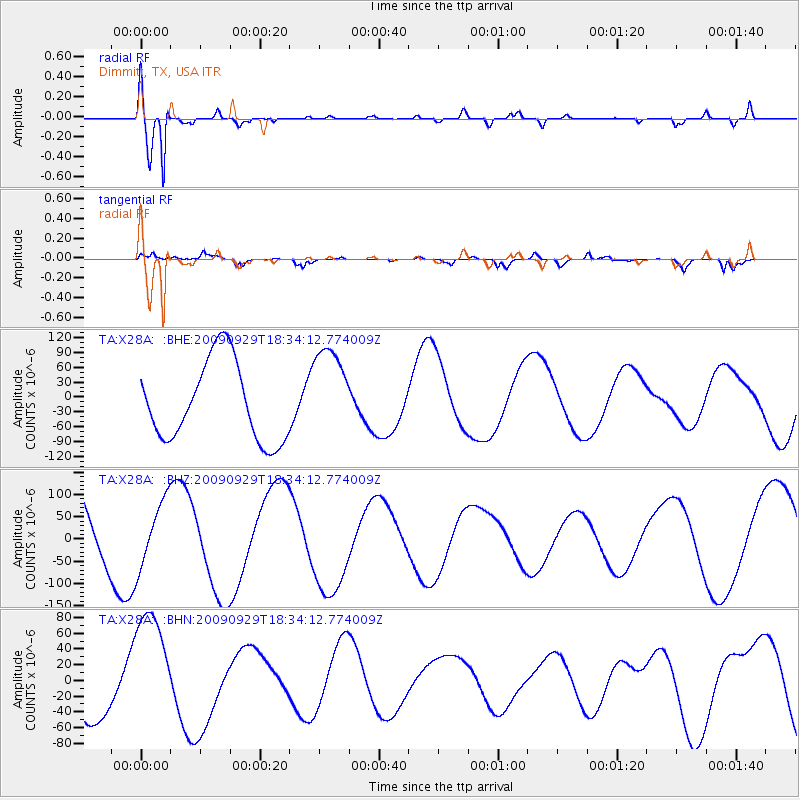
X28A Dimmitt, TX, USA - Earthquake Result Viewer

| Earthquake location: |
Tonga Islands |
| Earthquake latitude/longitude: |
-16.1/-173.3 |
| Earthquake time(UTC): |
2009/09/29 (272) 18:22:13 GMT |
| Earthquake Depth: |
10 km |
| Earthquake Magnitude: |
5.7 MB |
| Earthquake Catalog/Contributor: |
WHDF/NEIC |
|
| Network: |
TA USArray Transportable Network (new EarthScope stations) |
| Station: |
X28A Dimmitt, TX, USA |
| Lat/Lon: |
34.52 N/102.20 W |
| Elevation: |
1160 m |
|
| Distance: |
84.2 deg |
| Az: |
51.731 deg |
| Baz: |
246.049 deg |
| Ray Param: |
0.045681175 |
| Estimated Moho Depth: |
24.75 km |
| Estimated Crust Vp/Vs: |
2.10 |
| Assumed Crust Vp: |
6.242 km/s |
| Estimated Crust Vs: |
2.976 km/s |
| Estimated Crust Poisson's Ratio: |
0.35 |
|
| Radial Match: |
95.69868 % |
| Radial Bump: |
352 |
| Transverse Match: |
47.92022 % |
| Transverse Bump: |
400 |
| SOD ConfigId: |
2622 |
| Insert Time: |
2010-03-06 00:02:19.815 +0000 |
| GWidth: |
2.5 |
| Max Bumps: |
400 |
| Tol: |
0.001 |
|
Signal To Noise
| Channel | StoN | STA | LTA |
| TA:X28A: :BHZ:20090929T18:34:12.774009Z | 0.6947525 | 7.2589355E-5 | 1.0448232E-4 |
| TA:X28A: :BHN:20090929T18:34:12.774009Z | 2.246892 | 7.7816105E-5 | 3.4632776E-5 |
| TA:X28A: :BHE:20090929T18:34:12.774009Z | 1.1946565 | 9.590724E-5 | 8.028018E-5 |
| Arrivals |
| Ps | 4.4 SECOND |
| PpPs | 12 SECOND |
| PsPs/PpSs | 16 SECOND |


