You are here: Home > Network List > TA - USArray Transportable Network (new EarthScope stations) Stations List
> Station X28A Dimmitt, TX, USA > Earthquake Result Viewer
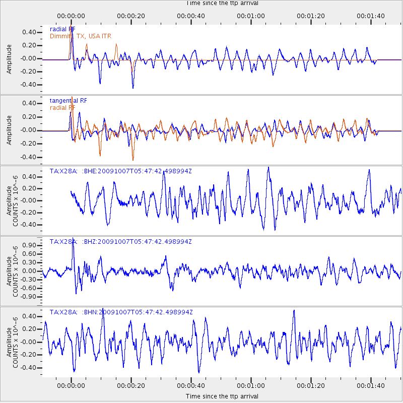
X28A Dimmitt, TX, USA - Earthquake Result Viewer
*The percent match for this event was below the threshold and hence no stack was calculated.
| Earthquake location: |
Rat Islands, Aleutian Islands |
| Earthquake latitude/longitude: |
52.2/178.1 |
| Earthquake time(UTC): |
2009/10/07 (280) 05:38:37 GMT |
| Earthquake Depth: |
138 km |
| Earthquake Magnitude: |
5.6 MB, 5.6 MW, 5.6 MW |
| Earthquake Catalog/Contributor: |
WHDF/NEIC |
|
| Network: |
TA USArray Transportable Network (new EarthScope stations) |
| Station: |
X28A Dimmitt, TX, USA |
| Lat/Lon: |
34.52 N/102.20 W |
| Elevation: |
1160 m |
|
| Distance: |
57.7 deg |
| Az: |
74.078 deg |
| Baz: |
314.153 deg |
| Ray Param: |
$rayparam |
*The percent match for this event was below the threshold and hence was not used in the summary stack. |
|
| Radial Match: |
63.066788 % |
| Radial Bump: |
341 |
| Transverse Match: |
51.32008 % |
| Transverse Bump: |
400 |
| SOD ConfigId: |
2622 |
| Insert Time: |
2010-03-06 00:03:02.054 +0000 |
| GWidth: |
2.5 |
| Max Bumps: |
400 |
| Tol: |
0.001 |
|
Signal To Noise
| Channel | StoN | STA | LTA |
| TA:X28A: :BHZ:20091007T05:47:42.498994Z | 3.3454318 | 4.3440232E-7 | 1.2984941E-7 |
| TA:X28A: :BHN:20091007T05:47:42.498994Z | 1.6014227 | 1.9425042E-7 | 1.2129865E-7 |
| TA:X28A: :BHE:20091007T05:47:42.498994Z | 1.5610914 | 2.304582E-7 | 1.4762634E-7 |
| Arrivals |
| Ps | |
| PpPs | |
| PsPs/PpSs | |


