You are here: Home > Network List > TA - USArray Transportable Network (new EarthScope stations) Stations List
> Station X28A Dimmitt, TX, USA > Earthquake Result Viewer
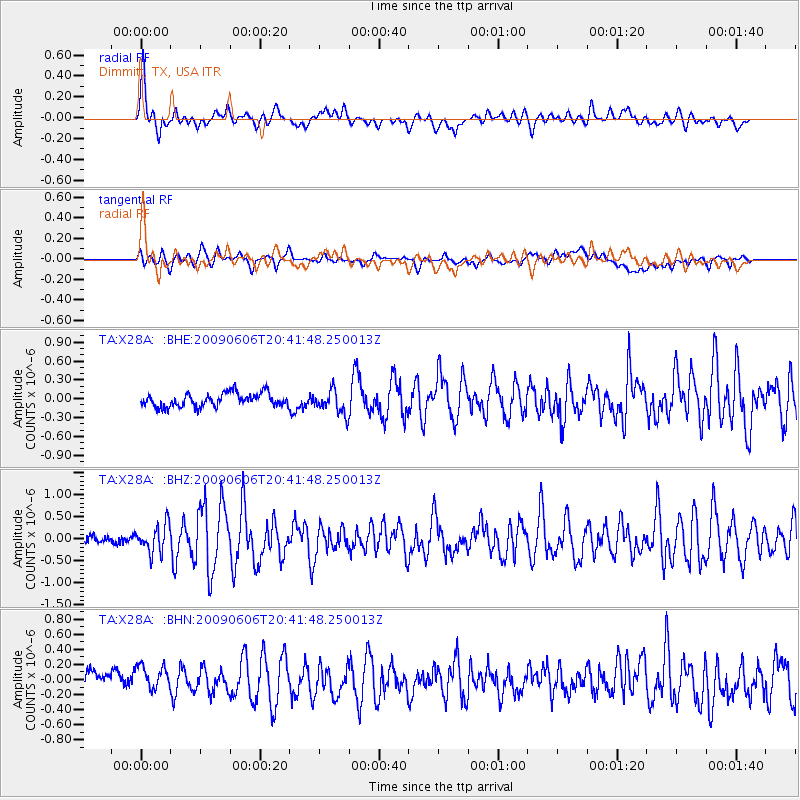
X28A Dimmitt, TX, USA - Earthquake Result Viewer
*The percent match for this event was below the threshold and hence no stack was calculated.
| Earthquake location: |
Northern Mid-Atlantic Ridge |
| Earthquake latitude/longitude: |
23.9/-46.1 |
| Earthquake time(UTC): |
2009/06/06 (157) 20:33:28 GMT |
| Earthquake Depth: |
14 km |
| Earthquake Magnitude: |
6.0 MB, 5.7 MS, 6.0 MW, 6.0 MW |
| Earthquake Catalog/Contributor: |
WHDF/NEIC |
|
| Network: |
TA USArray Transportable Network (new EarthScope stations) |
| Station: |
X28A Dimmitt, TX, USA |
| Lat/Lon: |
34.52 N/102.20 W |
| Elevation: |
1160 m |
|
| Distance: |
49.6 deg |
| Az: |
295.789 deg |
| Baz: |
86.679 deg |
| Ray Param: |
$rayparam |
*The percent match for this event was below the threshold and hence was not used in the summary stack. |
|
| Radial Match: |
72.83113 % |
| Radial Bump: |
400 |
| Transverse Match: |
66.65973 % |
| Transverse Bump: |
400 |
| SOD ConfigId: |
2648 |
| Insert Time: |
2010-03-06 00:03:19.218 +0000 |
| GWidth: |
2.5 |
| Max Bumps: |
400 |
| Tol: |
0.001 |
|
Signal To Noise
| Channel | StoN | STA | LTA |
| TA:X28A: :BHZ:20090606T20:41:48.250013Z | 3.74151 | 3.1818988E-7 | 8.5043176E-8 |
| TA:X28A: :BHN:20090606T20:41:48.250013Z | 1.4644607 | 1.7135142E-7 | 1.1700649E-7 |
| TA:X28A: :BHE:20090606T20:41:48.250013Z | 1.7584018 | 1.8822013E-7 | 1.07040464E-7 |
| Arrivals |
| Ps | |
| PpPs | |
| PsPs/PpSs | |


