You are here: Home > Network List > TA - USArray Transportable Network (new EarthScope stations) Stations List
> Station MDND Maddock, ND, USA > Earthquake Result Viewer
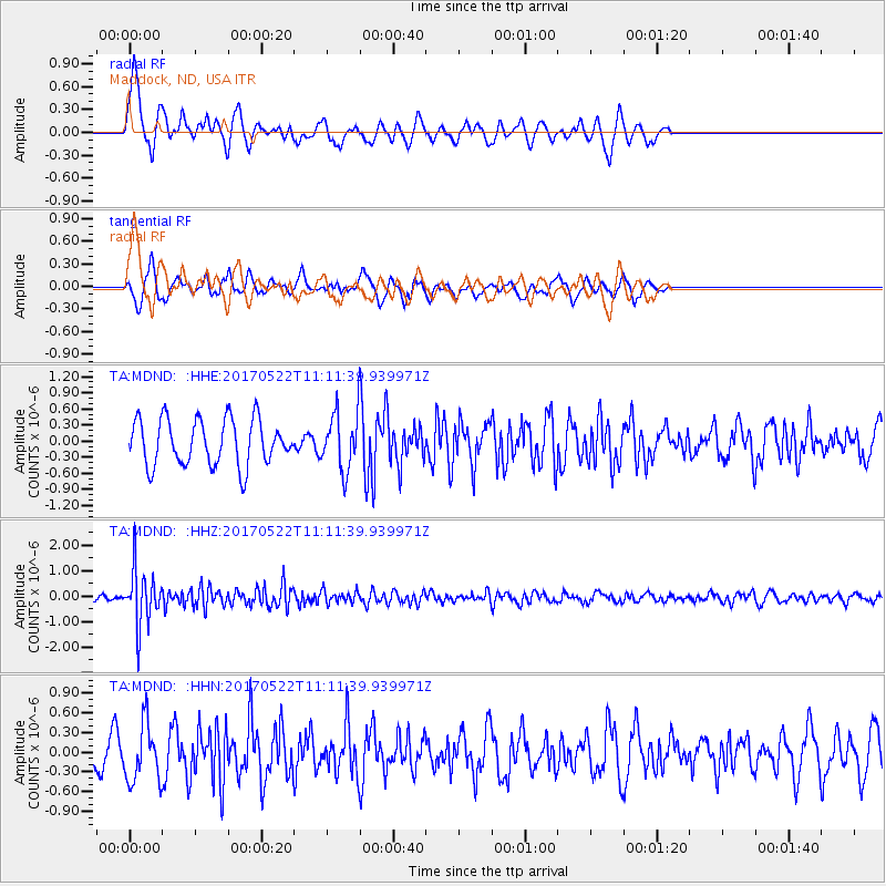
MDND Maddock, ND, USA - Earthquake Result Viewer
*The percent match for this event was below the threshold and hence no stack was calculated.
| Earthquake location: |
Kuril Islands |
| Earthquake latitude/longitude: |
43.9/147.7 |
| Earthquake time(UTC): |
2017/05/22 (142) 11:00:57 GMT |
| Earthquake Depth: |
54 km |
| Earthquake Magnitude: |
5.5 Mww |
| Earthquake Catalog/Contributor: |
NEIC PDE/us |
|
| Network: |
TA USArray Transportable Network (new EarthScope stations) |
| Station: |
MDND Maddock, ND, USA |
| Lat/Lon: |
47.85 N/99.60 W |
| Elevation: |
479 m |
|
| Distance: |
71.1 deg |
| Az: |
41.055 deg |
| Baz: |
315.206 deg |
| Ray Param: |
$rayparam |
*The percent match for this event was below the threshold and hence was not used in the summary stack. |
|
| Radial Match: |
56.95127 % |
| Radial Bump: |
373 |
| Transverse Match: |
45.423088 % |
| Transverse Bump: |
360 |
| SOD ConfigId: |
13570011 |
| Insert Time: |
2019-04-28 01:56:08.719 +0000 |
| GWidth: |
2.5 |
| Max Bumps: |
400 |
| Tol: |
0.001 |
|
Signal To Noise
| Channel | StoN | STA | LTA |
| TA:MDND: :HHZ:20170522T11:11:39.939971Z | 8.632382 | 1.0667638E-6 | 1.2357698E-7 |
| TA:MDND: :HHN:20170522T11:11:39.939971Z | 1.4157338 | 4.367047E-7 | 3.0846527E-7 |
| TA:MDND: :HHE:20170522T11:11:39.939971Z | 1.213223 | 5.17155E-7 | 4.2626542E-7 |
| Arrivals |
| Ps | |
| PpPs | |
| PsPs/PpSs | |


