You are here: Home > Network List > TA - USArray Transportable Network (new EarthScope stations) Stations List
> Station MSTX Muleshoe, TX, USA > Earthquake Result Viewer
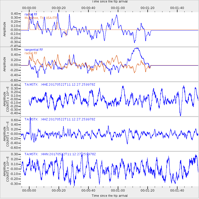
MSTX Muleshoe, TX, USA - Earthquake Result Viewer
*The percent match for this event was below the threshold and hence no stack was calculated.
| Earthquake location: |
Kuril Islands |
| Earthquake latitude/longitude: |
43.9/147.7 |
| Earthquake time(UTC): |
2017/05/22 (142) 11:00:57 GMT |
| Earthquake Depth: |
54 km |
| Earthquake Magnitude: |
5.5 Mww |
| Earthquake Catalog/Contributor: |
NEIC PDE/us |
|
| Network: |
TA USArray Transportable Network (new EarthScope stations) |
| Station: |
MSTX Muleshoe, TX, USA |
| Lat/Lon: |
33.97 N/102.77 W |
| Elevation: |
1167 m |
|
| Distance: |
79.4 deg |
| Az: |
52.841 deg |
| Baz: |
316.138 deg |
| Ray Param: |
$rayparam |
*The percent match for this event was below the threshold and hence was not used in the summary stack. |
|
| Radial Match: |
47.125256 % |
| Radial Bump: |
400 |
| Transverse Match: |
54.3624 % |
| Transverse Bump: |
400 |
| SOD ConfigId: |
13570011 |
| Insert Time: |
2019-04-28 01:56:09.039 +0000 |
| GWidth: |
2.5 |
| Max Bumps: |
400 |
| Tol: |
0.001 |
|
Signal To Noise
| Channel | StoN | STA | LTA |
| TA:MSTX: :HHZ:20170522T11:12:27.259978Z | 2.5305715 | 2.5109486E-7 | 9.9224565E-8 |
| TA:MSTX: :HHN:20170522T11:12:27.259978Z | 0.9907948 | 1.5956681E-7 | 1.610493E-7 |
| TA:MSTX: :HHE:20170522T11:12:27.259978Z | 1.3790145 | 1.4889795E-7 | 1.0797418E-7 |
| Arrivals |
| Ps | |
| PpPs | |
| PsPs/PpSs | |


