You are here: Home > Network List > TJ - Tajikistan National Seismic Network Stations List
> Station GARM Garm, Tajikistan > Earthquake Result Viewer
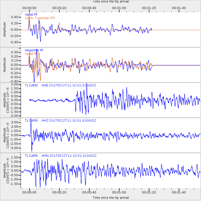
GARM Garm, Tajikistan - Earthquake Result Viewer
*The percent match for this event was below the threshold and hence no stack was calculated.
| Earthquake location: |
Kuril Islands |
| Earthquake latitude/longitude: |
43.9/147.7 |
| Earthquake time(UTC): |
2017/05/22 (142) 11:00:57 GMT |
| Earthquake Depth: |
54 km |
| Earthquake Magnitude: |
5.5 Mww |
| Earthquake Catalog/Contributor: |
NEIC PDE/us |
|
| Network: |
TJ Tajikistan National Seismic Network |
| Station: |
GARM Garm, Tajikistan |
| Lat/Lon: |
39.00 N/70.32 E |
| Elevation: |
1305 m |
|
| Distance: |
56.2 deg |
| Az: |
293.801 deg |
| Baz: |
58.044 deg |
| Ray Param: |
$rayparam |
*The percent match for this event was below the threshold and hence was not used in the summary stack. |
|
| Radial Match: |
76.58088 % |
| Radial Bump: |
400 |
| Transverse Match: |
78.12948 % |
| Transverse Bump: |
400 |
| SOD ConfigId: |
13570011 |
| Insert Time: |
2019-04-28 01:56:59.582 +0000 |
| GWidth: |
2.5 |
| Max Bumps: |
400 |
| Tol: |
0.001 |
|
Signal To Noise
| Channel | StoN | STA | LTA |
| TJ:GARM: :HHZ:20170522T11:10:01.910002Z | 12.6600065 | 1.4719043E-6 | 1.162641E-7 |
| TJ:GARM: :HHN:20170522T11:10:01.910002Z | 6.360369 | 5.8360695E-7 | 9.175677E-8 |
| TJ:GARM: :HHE:20170522T11:10:01.910002Z | 8.54399 | 6.303184E-7 | 7.377331E-8 |
| Arrivals |
| Ps | |
| PpPs | |
| PsPs/PpSs | |


