You are here: Home > Network List > CI - Caltech Regional Seismic Network Stations List
> Station SWS Sam W. Stewart, Westmorland, CA, USA > Earthquake Result Viewer
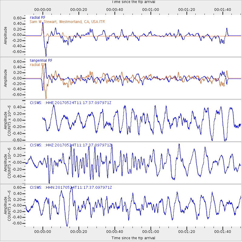
SWS Sam W. Stewart, Westmorland, CA, USA - Earthquake Result Viewer
*The percent match for this event was below the threshold and hence no stack was calculated.
| Earthquake location: |
Solomon Islands |
| Earthquake latitude/longitude: |
-10.0/161.9 |
| Earthquake time(UTC): |
2017/05/24 (144) 11:05:19 GMT |
| Earthquake Depth: |
55 km |
| Earthquake Magnitude: |
5.5 Mww |
| Earthquake Catalog/Contributor: |
NEIC PDE/us |
|
| Network: |
CI Caltech Regional Seismic Network |
| Station: |
SWS Sam W. Stewart, Westmorland, CA, USA |
| Lat/Lon: |
32.94 N/115.80 W |
| Elevation: |
140 m |
|
| Distance: |
89.0 deg |
| Az: |
56.462 deg |
| Baz: |
257.508 deg |
| Ray Param: |
$rayparam |
*The percent match for this event was below the threshold and hence was not used in the summary stack. |
|
| Radial Match: |
62.120007 % |
| Radial Bump: |
400 |
| Transverse Match: |
51.17588 % |
| Transverse Bump: |
400 |
| SOD ConfigId: |
13570011 |
| Insert Time: |
2019-04-28 02:04:04.711 +0000 |
| GWidth: |
2.5 |
| Max Bumps: |
400 |
| Tol: |
0.001 |
|
Signal To Noise
| Channel | StoN | STA | LTA |
| CI:SWS: :HHZ:20170524T11:17:37.097971Z | 2.1027932 | 1.9364435E-7 | 9.208911E-8 |
| CI:SWS: :HHN:20170524T11:17:37.097971Z | 0.77203244 | 2.36545E-7 | 3.0639256E-7 |
| CI:SWS: :HHE:20170524T11:17:37.097971Z | 1.2548804 | 2.2375148E-7 | 1.7830503E-7 |
| Arrivals |
| Ps | |
| PpPs | |
| PsPs/PpSs | |


