You are here: Home > Network List > TA - USArray Transportable Network (new EarthScope stations) Stations List
> Station MDND Maddock, ND, USA > Earthquake Result Viewer
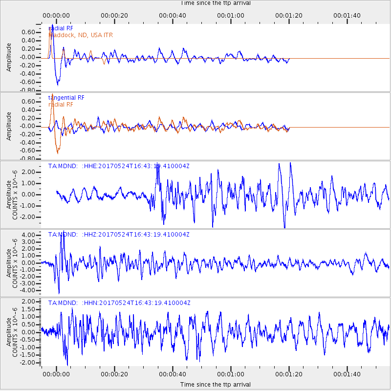
MDND Maddock, ND, USA - Earthquake Result Viewer
*The percent match for this event was below the threshold and hence no stack was calculated.
| Earthquake location: |
Fox Islands, Aleutian Islands |
| Earthquake latitude/longitude: |
52.4/-166.7 |
| Earthquake time(UTC): |
2017/05/24 (144) 16:36:01 GMT |
| Earthquake Depth: |
2.0 km |
| Earthquake Magnitude: |
5.7 Mi |
| Earthquake Catalog/Contributor: |
NEIC PDE/at |
|
| Network: |
TA USArray Transportable Network (new EarthScope stations) |
| Station: |
MDND Maddock, ND, USA |
| Lat/Lon: |
47.85 N/99.60 W |
| Elevation: |
479 m |
|
| Distance: |
41.9 deg |
| Az: |
68.412 deg |
| Baz: |
302.276 deg |
| Ray Param: |
$rayparam |
*The percent match for this event was below the threshold and hence was not used in the summary stack. |
|
| Radial Match: |
89.099205 % |
| Radial Bump: |
308 |
| Transverse Match: |
69.985176 % |
| Transverse Bump: |
400 |
| SOD ConfigId: |
13570011 |
| Insert Time: |
2019-04-28 02:16:55.589 +0000 |
| GWidth: |
2.5 |
| Max Bumps: |
400 |
| Tol: |
0.001 |
|
Signal To Noise
| Channel | StoN | STA | LTA |
| TA:MDND: :HHZ:20170524T16:43:19.410004Z | 11.967142 | 2.0612101E-6 | 1.7223913E-7 |
| TA:MDND: :HHN:20170524T16:43:19.410004Z | 2.4907587 | 8.1342864E-7 | 3.2657866E-7 |
| TA:MDND: :HHE:20170524T16:43:19.410004Z | 3.6729548 | 1.2542489E-6 | 3.4148226E-7 |
| Arrivals |
| Ps | |
| PpPs | |
| PsPs/PpSs | |


