You are here: Home > Network List > TA - USArray Transportable Network (new EarthScope stations) Stations List
> Station TUL3 Leonard, OK, USA > Earthquake Result Viewer
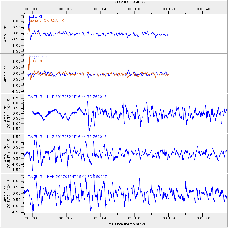
TUL3 Leonard, OK, USA - Earthquake Result Viewer
*The percent match for this event was below the threshold and hence no stack was calculated.
| Earthquake location: |
Fox Islands, Aleutian Islands |
| Earthquake latitude/longitude: |
52.4/-166.7 |
| Earthquake time(UTC): |
2017/05/24 (144) 16:36:01 GMT |
| Earthquake Depth: |
2.0 km |
| Earthquake Magnitude: |
5.7 Mi |
| Earthquake Catalog/Contributor: |
NEIC PDE/at |
|
| Network: |
TA USArray Transportable Network (new EarthScope stations) |
| Station: |
TUL3 Leonard, OK, USA |
| Lat/Lon: |
35.91 N/95.79 W |
| Elevation: |
265 m |
|
| Distance: |
51.4 deg |
| Az: |
79.095 deg |
| Baz: |
312.199 deg |
| Ray Param: |
$rayparam |
*The percent match for this event was below the threshold and hence was not used in the summary stack. |
|
| Radial Match: |
82.24686 % |
| Radial Bump: |
365 |
| Transverse Match: |
54.00038 % |
| Transverse Bump: |
400 |
| SOD ConfigId: |
13570011 |
| Insert Time: |
2019-04-28 02:17:07.080 +0000 |
| GWidth: |
2.5 |
| Max Bumps: |
400 |
| Tol: |
0.001 |
|
Signal To Noise
| Channel | StoN | STA | LTA |
| TA:TUL3: :HHZ:20170524T16:44:33.76001Z | 12.864702 | 9.173997E-7 | 7.131138E-8 |
| TA:TUL3: :HHN:20170524T16:44:33.76001Z | 4.6079636 | 8.6126204E-7 | 1.869073E-7 |
| TA:TUL3: :HHE:20170524T16:44:33.76001Z | 3.1756623 | 8.948888E-7 | 2.8179593E-7 |
| Arrivals |
| Ps | |
| PpPs | |
| PsPs/PpSs | |


