You are here: Home > Network List > UW - Pacific Northwest Regional Seismic Network Stations List
> Station UMAT Pilot Rock, OR, USA > Earthquake Result Viewer
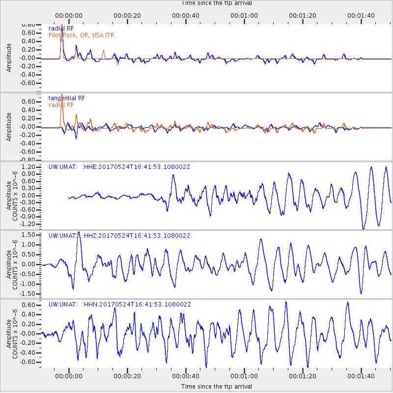
UMAT Pilot Rock, OR, USA - Earthquake Result Viewer
*The percent match for this event was below the threshold and hence no stack was calculated.
| Earthquake location: |
Fox Islands, Aleutian Islands |
| Earthquake latitude/longitude: |
52.4/-166.7 |
| Earthquake time(UTC): |
2017/05/24 (144) 16:36:01 GMT |
| Earthquake Depth: |
2.0 km |
| Earthquake Magnitude: |
5.7 Mi |
| Earthquake Catalog/Contributor: |
NEIC PDE/at |
|
| Network: |
UW Pacific Northwest Regional Seismic Network |
| Station: |
UMAT Pilot Rock, OR, USA |
| Lat/Lon: |
45.29 N/118.96 W |
| Elevation: |
1318 m |
|
| Distance: |
31.7 deg |
| Az: |
83.6 deg |
| Baz: |
300.433 deg |
| Ray Param: |
$rayparam |
*The percent match for this event was below the threshold and hence was not used in the summary stack. |
|
| Radial Match: |
81.95306 % |
| Radial Bump: |
235 |
| Transverse Match: |
67.4673 % |
| Transverse Bump: |
400 |
| SOD ConfigId: |
13570011 |
| Insert Time: |
2019-04-28 02:17:53.155 +0000 |
| GWidth: |
2.5 |
| Max Bumps: |
400 |
| Tol: |
0.001 |
|
Signal To Noise
| Channel | StoN | STA | LTA |
| UW:UMAT: :HHZ:20170524T16:41:53.108002Z | 9.176654 | 8.806202E-7 | 9.59631E-8 |
| UW:UMAT: :HHN:20170524T16:41:53.108002Z | 1.7495093 | 2.3087162E-7 | 1.3196365E-7 |
| UW:UMAT: :HHE:20170524T16:41:53.108002Z | 6.651077 | 4.1920822E-7 | 6.302862E-8 |
| Arrivals |
| Ps | |
| PpPs | |
| PsPs/PpSs | |


