You are here: Home > Network List > WY - Yellowstone Wyoming Seismic Network Stations List
> Station YHH Holmes Hill, YNP, WY, USA > Earthquake Result Viewer
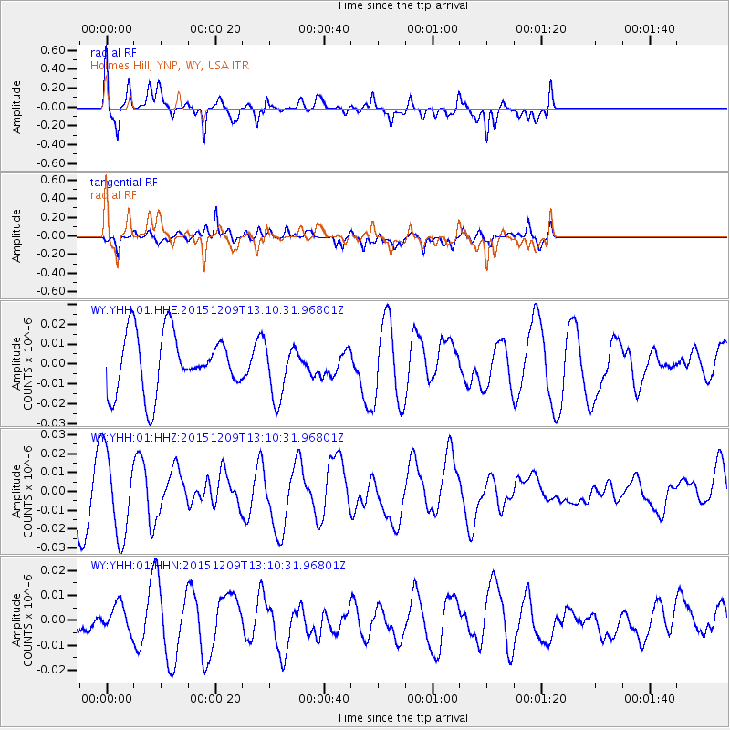
YHH Holmes Hill, YNP, WY, USA - Earthquake Result Viewer
*The percent match for this event was below the threshold and hence no stack was calculated.
| Earthquake location: |
Fiji Islands Region |
| Earthquake latitude/longitude: |
-16.6/175.3 |
| Earthquake time(UTC): |
2015/12/09 (343) 12:58:01 GMT |
| Earthquake Depth: |
10 km |
| Earthquake Magnitude: |
5.7 MB |
| Earthquake Catalog/Contributor: |
NEIC PDE/NEIC COMCAT |
|
| Network: |
WY Yellowstone Wyoming Seismic Network |
| Station: |
YHH Holmes Hill, YNP, WY, USA |
| Lat/Lon: |
44.79 N/110.85 W |
| Elevation: |
2717 m |
|
| Distance: |
90.6 deg |
| Az: |
43.165 deg |
| Baz: |
247.087 deg |
| Ray Param: |
$rayparam |
*The percent match for this event was below the threshold and hence was not used in the summary stack. |
|
| Radial Match: |
59.864082 % |
| Radial Bump: |
400 |
| Transverse Match: |
41.56423 % |
| Transverse Bump: |
397 |
| SOD ConfigId: |
1259291 |
| Insert Time: |
2015-12-23 13:50:00.530 +0000 |
| GWidth: |
2.5 |
| Max Bumps: |
400 |
| Tol: |
0.001 |
|
Signal To Noise
| Channel | StoN | STA | LTA |
| WY:YHH:01:HHZ:20151209T13:10:31.96801Z | 2.1653244 | 2.2430816E-8 | 1.0359102E-8 |
| WY:YHH:01:HHN:20151209T13:10:31.96801Z | 0.40518376 | 5.9891057E-9 | 1.4781208E-8 |
| WY:YHH:01:HHE:20151209T13:10:31.96801Z | 0.9489713 | 1.3963987E-8 | 1.4714868E-8 |
| Arrivals |
| Ps | |
| PpPs | |
| PsPs/PpSs | |


