
532A Rocksprings, TX, USA - Earthquake Result Viewer
| ||||||||||||||||||
| ||||||||||||||||||
| ||||||||||||||||||
|
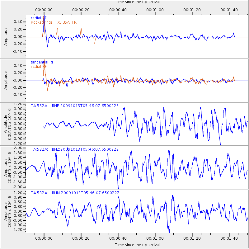
Signal To Noise
| Channel | StoN | STA | LTA |
| TA:532A: :BHZ:20091013T05:46:07.650022Z | 2.4390688 | 4.873587E-7 | 1.9981343E-7 |
| TA:532A: :BHN:20091013T05:46:07.650022Z | 0.74241006 | 1.3778832E-7 | 1.8559598E-7 |
| TA:532A: :BHE:20091013T05:46:07.650022Z | 1.0160183 | 1.06438996E-7 | 1.04760915E-7 |
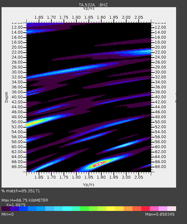
| Arrivals | |
| Ps | 9.6 SECOND |
| PpPs | 28 SECOND |
| PsPs/PpSs | 38 SECOND |

