
532A Rocksprings, TX, USA - Earthquake Result Viewer
| ||||||||||||||||||
| ||||||||||||||||||
| ||||||||||||||||||
|
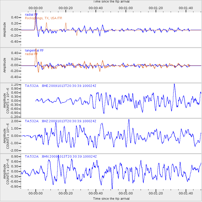
Signal To Noise
| Channel | StoN | STA | LTA |
| TA:532A: :BHZ:20091013T20:30:39.100024Z | 2.4434307 | 2.8574786E-7 | 1.1694535E-7 |
| TA:532A: :BHN:20091013T20:30:39.100024Z | 1.4047745 | 1.4571792E-7 | 1.03730464E-7 |
| TA:532A: :BHE:20091013T20:30:39.100024Z | 1.5889993 | 1.6681092E-7 | 1.04978604E-7 |
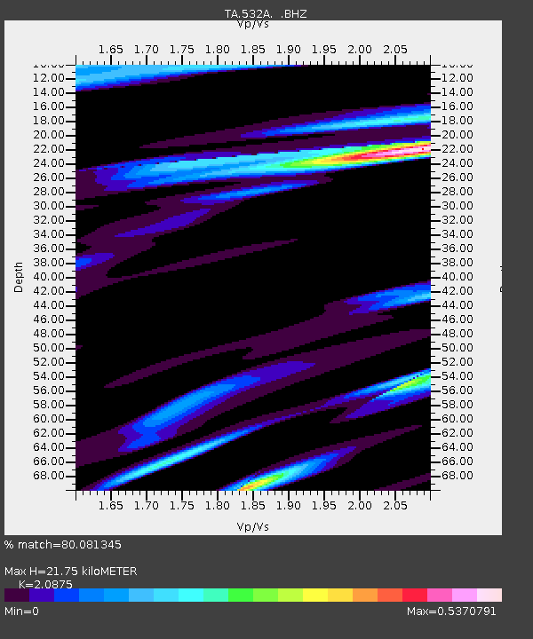
| Arrivals | |
| Ps | 3.8 SECOND |
| PpPs | 9.9 SECOND |
| PsPs/PpSs | 14 SECOND |

