
532A Rocksprings, TX, USA - Earthquake Result Viewer
| ||||||||||||||||||
| ||||||||||||||||||
| ||||||||||||||||||
|
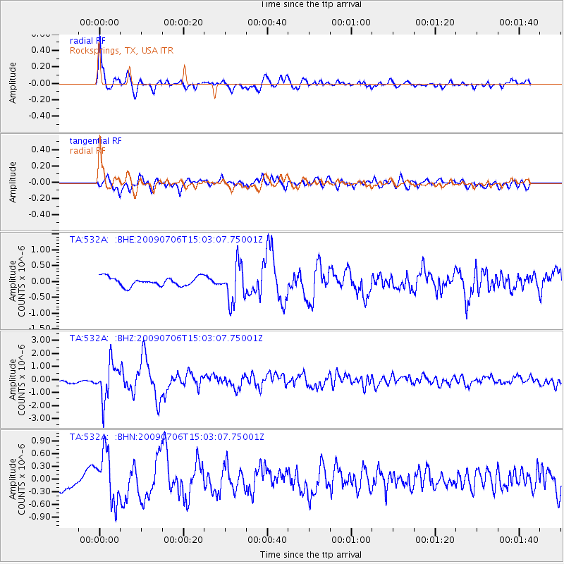
Signal To Noise
| Channel | StoN | STA | LTA |
| TA:532A: :BHZ:20090706T15:03:07.75001Z | 9.8207035 | 1.3903624E-6 | 1.4157462E-7 |
| TA:532A: :BHN:20090706T15:03:07.75001Z | 2.759433 | 6.0262E-7 | 2.1838544E-7 |
| TA:532A: :BHE:20090706T15:03:07.75001Z | 4.365971 | 6.005858E-7 | 1.3756063E-7 |
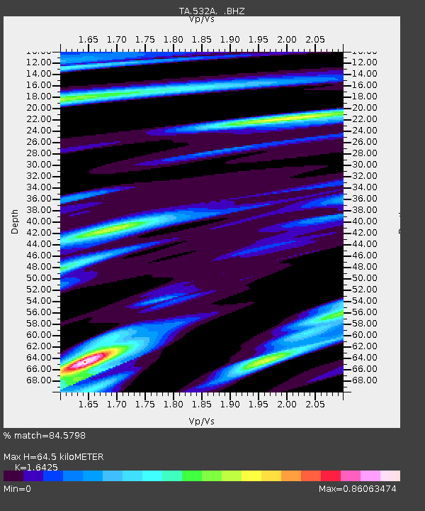
| Arrivals | |
| Ps | 6.7 SECOND |
| PpPs | 25 SECOND |
| PsPs/PpSs | 32 SECOND |

