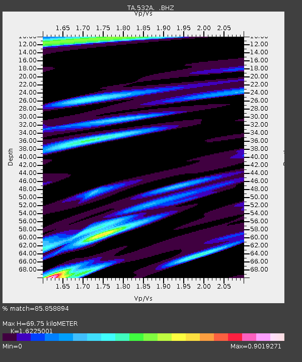
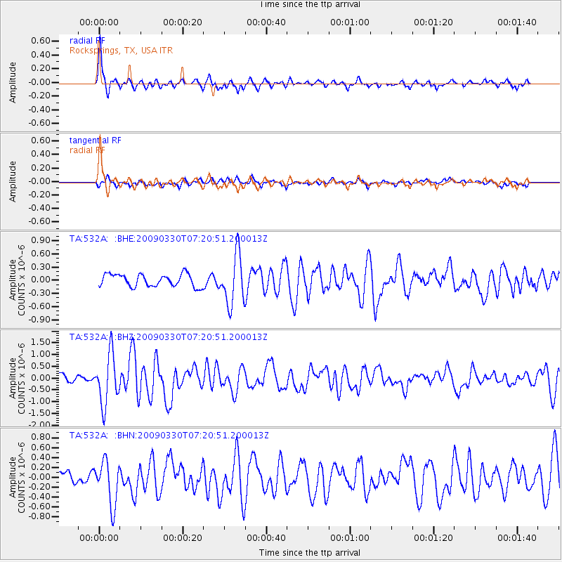
532A Rocksprings, TX, USA - Earthquake Result Viewer

Earthquake location: Kodiak Island Region, Alaska
Earthquake latitude/longitude: 56.5/-152.7
Earthquake time(UTC): 2009/03/30 (089) 07:13:07 GMT
Earthquake Depth: 21 km
Earthquake Magnitude: 5.9 MB, 5.9 MS, 5.9 MW, 5.9 MW
Earthquake Catalog/Contributor: WHDF/NEIC
Network: TA USArray Transportable Network (new EarthScope stations)
Station: 532A Rocksprings, TX, USA
Lat/Lon: 30.13 N/99.90 W
Elevation: 703 m
Distance: 45.1 deg
Az: 102.98 deg
Baz: 321.469 deg
Ray Param: 0.071460225
Estimated Moho Depth: 69.75 km
Estimated Crust Vp/Vs: 1.62
Assumed Crust Vp: 6.498 km/s
Estimated Crust Vs: 4.005 km/s
Estimated Crust Poisson's Ratio: 0.19
Radial Match: 85.858894 %
Radial Bump: 397
Transverse Match: 73.481125 %
Transverse Bump: 400
SOD ConfigId: 2658
Insert Time: 2010-03-06 00:09:31.420 +0000
GWidth: 2.5
Max Bumps: 400
Tol: 0.001

Signal To Noise

ChannelStoNSTALTA
TA:532A: :BHZ:20090330T07:20:51.200013Z4.8881451.077547E-62.2044091E-7
TA:532A: :BHN:20090330T07:20:51.200013Z4.66425564.559476E-79.775356E-8
TA:532A: :BHE:20090330T07:20:51.200013Z4.10424385.7730915E-71.4066153E-7
Arrivals
Ps7.2 SECOND
PpPs26 SECOND
PsPs/PpSs33 SECOND