You are here: Home > Network List > TA - USArray Transportable Network (new EarthScope stations) Stations List
> Station 532A Rocksprings, TX, USA > Earthquake Result Viewer
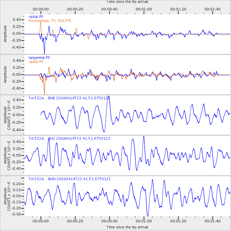
532A Rocksprings, TX, USA - Earthquake Result Viewer
*The percent match for this event was below the threshold and hence no stack was calculated.
| Earthquake location: |
Fiji Islands Region |
| Earthquake latitude/longitude: |
-16.3/-177.7 |
| Earthquake time(UTC): |
2009/04/14 (104) 23:29:33 GMT |
| Earthquake Depth: |
10 km |
| Earthquake Magnitude: |
5.5 MS, 5.4 MB, 5.9 MW, 5.9 MW |
| Earthquake Catalog/Contributor: |
WHDF/NEIC |
|
| Network: |
TA USArray Transportable Network (new EarthScope stations) |
| Station: |
532A Rocksprings, TX, USA |
| Lat/Lon: |
30.13 N/99.90 W |
| Elevation: |
703 m |
|
| Distance: |
87.9 deg |
| Az: |
57.934 deg |
| Baz: |
249.933 deg |
| Ray Param: |
$rayparam |
*The percent match for this event was below the threshold and hence was not used in the summary stack. |
|
| Radial Match: |
64.80737 % |
| Radial Bump: |
323 |
| Transverse Match: |
59.134346 % |
| Transverse Bump: |
392 |
| SOD ConfigId: |
2658 |
| Insert Time: |
2010-03-06 00:09:37.533 +0000 |
| GWidth: |
2.5 |
| Max Bumps: |
400 |
| Tol: |
0.001 |
|
Signal To Noise
| Channel | StoN | STA | LTA |
| TA:532A: :BHZ:20090414T23:41:51.675012Z | 3.0054545 | 2.2117479E-7 | 7.3591124E-8 |
| TA:532A: :BHN:20090414T23:41:51.675012Z | 0.7033726 | 6.252863E-8 | 8.88983E-8 |
| TA:532A: :BHE:20090414T23:41:51.675012Z | 1.2748917 | 1.9364359E-7 | 1.5189022E-7 |
| Arrivals |
| Ps | |
| PpPs | |
| PsPs/PpSs | |


