You are here: Home > Network List > GS - US Geological Survey Networks Stations List
> Station KAN13 Rinehart Farm > Earthquake Result Viewer
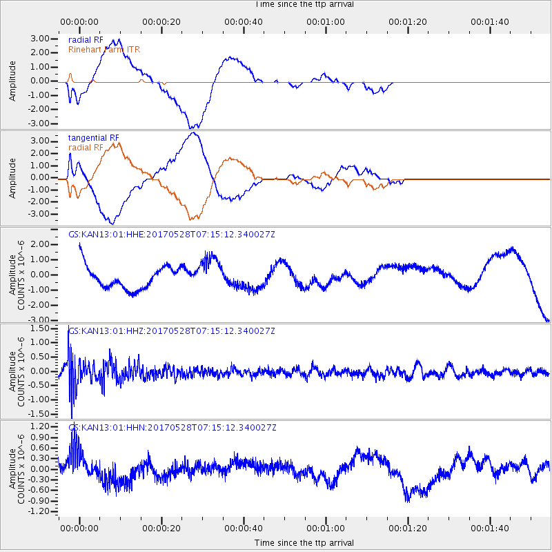
KAN13 Rinehart Farm - Earthquake Result Viewer
*The percent match for this event was below the threshold and hence no stack was calculated.
| Earthquake location: |
Andreanof Islands, Aleutian Is. |
| Earthquake latitude/longitude: |
51.6/-175.3 |
| Earthquake time(UTC): |
2017/05/28 (148) 07:06:14 GMT |
| Earthquake Depth: |
8.0 km |
| Earthquake Magnitude: |
5.6 Ml |
| Earthquake Catalog/Contributor: |
NEIC PDE/at |
|
| Network: |
GS US Geological Survey Networks |
| Station: |
KAN13 Rinehart Farm |
| Lat/Lon: |
37.01 N/97.48 W |
| Elevation: |
340 m |
|
| Distance: |
55.0 deg |
| Az: |
72.807 deg |
| Baz: |
311.86 deg |
| Ray Param: |
$rayparam |
*The percent match for this event was below the threshold and hence was not used in the summary stack. |
|
| Radial Match: |
46.246334 % |
| Radial Bump: |
400 |
| Transverse Match: |
44.191772 % |
| Transverse Bump: |
400 |
| SOD ConfigId: |
13570011 |
| Insert Time: |
2019-04-28 02:25:34.244 +0000 |
| GWidth: |
2.5 |
| Max Bumps: |
400 |
| Tol: |
0.001 |
|
Signal To Noise
| Channel | StoN | STA | LTA |
| GS:KAN13:01:HHZ:20170528T07:15:12.340027Z | 2.3032897 | 3.176156E-7 | 1.378965E-7 |
| GS:KAN13:01:HHN:20170528T07:15:12.340027Z | 1.9367882 | 3.7281438E-7 | 1.9249104E-7 |
| GS:KAN13:01:HHE:20170528T07:15:12.340027Z | 1.6668851 | 1.0200456E-6 | 6.1194714E-7 |
| Arrivals |
| Ps | |
| PpPs | |
| PsPs/PpSs | |


