You are here: Home > Network List > TA - USArray Transportable Network (new EarthScope stations) Stations List
> Station 532A Rocksprings, TX, USA > Earthquake Result Viewer
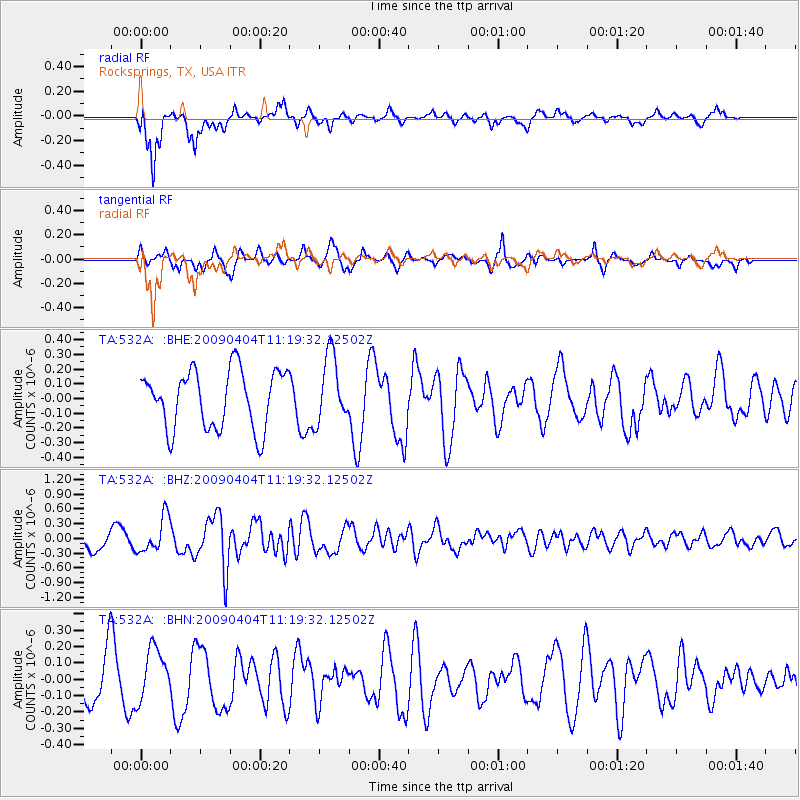
532A Rocksprings, TX, USA - Earthquake Result Viewer
*The percent match for this event was below the threshold and hence no stack was calculated.
| Earthquake location: |
Tonga Islands Region |
| Earthquake latitude/longitude: |
-22.5/-174.7 |
| Earthquake time(UTC): |
2009/04/04 (094) 11:07:12 GMT |
| Earthquake Depth: |
35 km |
| Earthquake Magnitude: |
5.5 MB, 5.4 MS, 5.5 MW, 5.5 MW |
| Earthquake Catalog/Contributor: |
WHDF/NEIC |
|
| Network: |
TA USArray Transportable Network (new EarthScope stations) |
| Station: |
532A Rocksprings, TX, USA |
| Lat/Lon: |
30.13 N/99.90 W |
| Elevation: |
703 m |
|
| Distance: |
88.8 deg |
| Az: |
56.724 deg |
| Baz: |
243.166 deg |
| Ray Param: |
$rayparam |
*The percent match for this event was below the threshold and hence was not used in the summary stack. |
|
| Radial Match: |
72.42279 % |
| Radial Bump: |
280 |
| Transverse Match: |
63.300682 % |
| Transverse Bump: |
318 |
| SOD ConfigId: |
2658 |
| Insert Time: |
2010-03-06 00:10:13.162 +0000 |
| GWidth: |
2.5 |
| Max Bumps: |
400 |
| Tol: |
0.001 |
|
Signal To Noise
| Channel | StoN | STA | LTA |
| TA:532A: :BHZ:20090404T11:19:32.12502Z | 1.973204 | 3.5485783E-7 | 1.7983838E-7 |
| TA:532A: :BHN:20090404T11:19:32.12502Z | 1.1070048 | 1.5738274E-7 | 1.4216988E-7 |
| TA:532A: :BHE:20090404T11:19:32.12502Z | 1.1655434 | 2.3021167E-7 | 1.9751444E-7 |
| Arrivals |
| Ps | |
| PpPs | |
| PsPs/PpSs | |


