You are here: Home > Network List > TA - USArray Transportable Network (new EarthScope stations) Stations List
> Station MSTX Muleshoe, TX, USA > Earthquake Result Viewer
MSTX Muleshoe, TX, USA - Earthquake Result Viewer
*The percent match for this event was below the threshold and hence no stack was calculated.
| Earthquake location: |
Andreanof Islands, Aleutian Is. |
| Earthquake latitude/longitude: |
51.6/-175.3 |
| Earthquake time(UTC): |
2017/05/28 (148) 07:06:14 GMT |
| Earthquake Depth: |
8.0 km |
| Earthquake Magnitude: |
5.6 Ml |
| Earthquake Catalog/Contributor: |
NEIC PDE/at |
|
| Network: |
TA USArray Transportable Network (new EarthScope stations) |
| Station: |
MSTX Muleshoe, TX, USA |
| Lat/Lon: |
33.97 N/102.77 W |
| Elevation: |
1167 m |
|
| Distance: |
53.8 deg |
| Az: |
79.141 deg |
| Baz: |
312.486 deg |
| Ray Param: |
$rayparam |
*The percent match for this event was below the threshold and hence was not used in the summary stack. |
|
| Radial Match: |
46.786064 % |
| Radial Bump: |
400 |
| Transverse Match: |
49.899208 % |
| Transverse Bump: |
400 |
| SOD ConfigId: |
13570011 |
| Insert Time: |
2019-04-28 02:30:21.782 +0000 |
| GWidth: |
2.5 |
| Max Bumps: |
400 |
| Tol: |
0.001 |
|
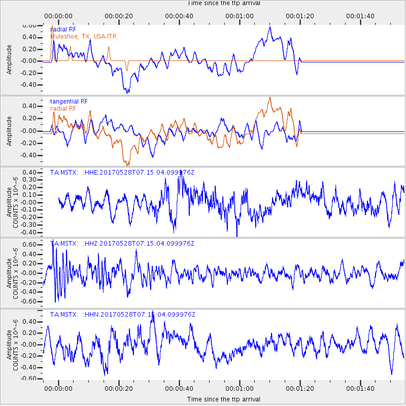
Signal To Noise
| Channel | StoN | STA | LTA |
| TA:MSTX: :HHZ:20170528T07:15:04.099976Z | 2.5877216 | 2.9590652E-7 | 1.14350215E-7 |
| TA:MSTX: :HHN:20170528T07:15:04.099976Z | 1.3832738 | 1.7199885E-7 | 1.2434187E-7 |
| TA:MSTX: :HHE:20170528T07:15:04.099976Z | 1.3238273 | 1.3851181E-7 | 1.0462982E-7 |
| Arrivals |
| Ps | |
| PpPs | |
| PsPs/PpSs | |


