You are here: Home > Network List > IU - Global Seismograph Network (GSN - IRIS/USGS) Stations List
> Station CTAO Charters Towers, Australia > Earthquake Result Viewer
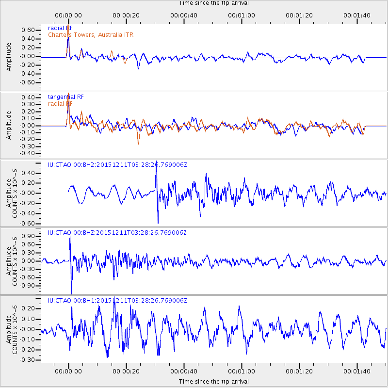
CTAO Charters Towers, Australia - Earthquake Result Viewer
*The percent match for this event was below the threshold and hence no stack was calculated.
| Earthquake location: |
Southern Sumatra, Indonesia |
| Earthquake latitude/longitude: |
-5.1/102.9 |
| Earthquake time(UTC): |
2015/12/11 (345) 03:20:49 GMT |
| Earthquake Depth: |
52 km |
| Earthquake Magnitude: |
5.6 MB |
| Earthquake Catalog/Contributor: |
NEIC PDE/NEIC COMCAT |
|
| Network: |
IU Global Seismograph Network (GSN - IRIS/USGS) |
| Station: |
CTAO Charters Towers, Australia |
| Lat/Lon: |
20.09 S/146.25 E |
| Elevation: |
357 m |
|
| Distance: |
44.7 deg |
| Az: |
113.473 deg |
| Baz: |
283.555 deg |
| Ray Param: |
$rayparam |
*The percent match for this event was below the threshold and hence was not used in the summary stack. |
|
| Radial Match: |
41.742733 % |
| Radial Bump: |
358 |
| Transverse Match: |
46.034523 % |
| Transverse Bump: |
400 |
| SOD ConfigId: |
1259291 |
| Insert Time: |
2015-12-25 04:21:38.631 +0000 |
| GWidth: |
2.5 |
| Max Bumps: |
400 |
| Tol: |
0.001 |
|
Signal To Noise
| Channel | StoN | STA | LTA |
| IU:CTAO:00:BHZ:20151211T03:28:26.769006Z | 5.200205 | 3.6218694E-7 | 6.9648586E-8 |
| IU:CTAO:00:BH1:20151211T03:28:26.769006Z | 1.435875 | 8.502686E-8 | 5.921606E-8 |
| IU:CTAO:00:BH2:20151211T03:28:26.769006Z | 2.2233837 | 2.2197445E-7 | 9.983632E-8 |
| Arrivals |
| Ps | |
| PpPs | |
| PsPs/PpSs | |


