You are here: Home > Network List > TA - USArray Transportable Network (new EarthScope stations) Stations List
> Station TUL3 Leonard, OK, USA > Earthquake Result Viewer
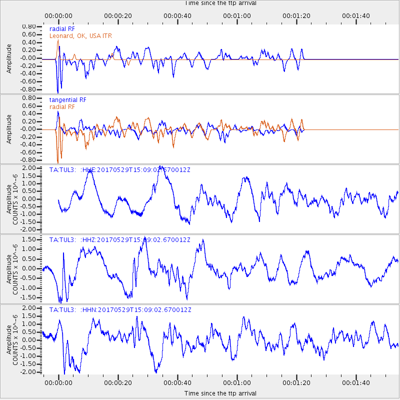
TUL3 Leonard, OK, USA - Earthquake Result Viewer
*The percent match for this event was below the threshold and hence no stack was calculated.
| Earthquake location: |
S. Chile-Argentina Border Region |
| Earthquake latitude/longitude: |
-37.3/-71.6 |
| Earthquake time(UTC): |
2017/05/29 (149) 14:57:54 GMT |
| Earthquake Depth: |
87 km |
| Earthquake Magnitude: |
5.7 Mwr |
| Earthquake Catalog/Contributor: |
NEIC PDE/us |
|
| Network: |
TA USArray Transportable Network (new EarthScope stations) |
| Station: |
TUL3 Leonard, OK, USA |
| Lat/Lon: |
35.91 N/95.79 W |
| Elevation: |
265 m |
|
| Distance: |
76.3 deg |
| Az: |
339.988 deg |
| Baz: |
160.369 deg |
| Ray Param: |
$rayparam |
*The percent match for this event was below the threshold and hence was not used in the summary stack. |
|
| Radial Match: |
44.240593 % |
| Radial Bump: |
400 |
| Transverse Match: |
51.592873 % |
| Transverse Bump: |
400 |
| SOD ConfigId: |
13570011 |
| Insert Time: |
2019-04-28 02:42:08.982 +0000 |
| GWidth: |
2.5 |
| Max Bumps: |
400 |
| Tol: |
0.001 |
|
Signal To Noise
| Channel | StoN | STA | LTA |
| TA:TUL3: :HHZ:20170529T15:09:02.670012Z | 2.2444315 | 1.106164E-6 | 4.928482E-7 |
| TA:TUL3: :HHN:20170529T15:09:02.670012Z | 1.1431563 | 1.0707506E-6 | 9.3666165E-7 |
| TA:TUL3: :HHE:20170529T15:09:02.670012Z | 1.4498669 | 1.121337E-6 | 7.7340695E-7 |
| Arrivals |
| Ps | |
| PpPs | |
| PsPs/PpSs | |


