You are here: Home > Network List > CI - Caltech Regional Seismic Network Stations List
> Station MPM Manuel Prospect Mine, California, USA > Earthquake Result Viewer
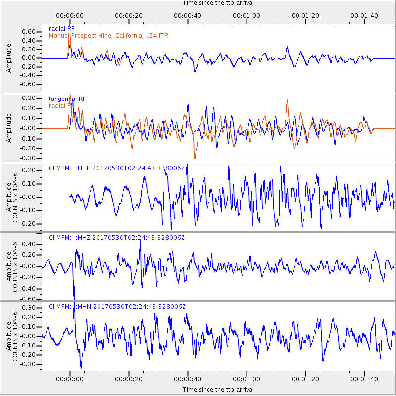
MPM Manuel Prospect Mine, California, USA - Earthquake Result Viewer
*The percent match for this event was below the threshold and hence no stack was calculated.
| Earthquake location: |
Kenai Peninsula, Alaska |
| Earthquake latitude/longitude: |
60.8/-151.8 |
| Earthquake time(UTC): |
2017/05/30 (150) 02:18:45 GMT |
| Earthquake Depth: |
78 km |
| Earthquake Magnitude: |
5.2 Mww |
| Earthquake Catalog/Contributor: |
NEIC PDE/ak |
|
| Network: |
CI Caltech Regional Seismic Network |
| Station: |
MPM Manuel Prospect Mine, California, USA |
| Lat/Lon: |
36.06 N/117.49 W |
| Elevation: |
185 m |
|
| Distance: |
33.0 deg |
| Az: |
122.955 deg |
| Baz: |
329.523 deg |
| Ray Param: |
$rayparam |
*The percent match for this event was below the threshold and hence was not used in the summary stack. |
|
| Radial Match: |
52.820644 % |
| Radial Bump: |
400 |
| Transverse Match: |
53.502377 % |
| Transverse Bump: |
400 |
| SOD ConfigId: |
13570011 |
| Insert Time: |
2019-04-28 02:44:38.248 +0000 |
| GWidth: |
2.5 |
| Max Bumps: |
400 |
| Tol: |
0.001 |
|
Signal To Noise
| Channel | StoN | STA | LTA |
| CI:MPM: :HHZ:20170530T02:24:43.328006Z | 2.5407038 | 2.0037419E-7 | 7.8865625E-8 |
| CI:MPM: :HHN:20170530T02:24:43.328006Z | 2.357671 | 1.6039311E-7 | 6.803032E-8 |
| CI:MPM: :HHE:20170530T02:24:43.328006Z | 2.0849829 | 1.1956928E-7 | 5.7347844E-8 |
| Arrivals |
| Ps | |
| PpPs | |
| PsPs/PpSs | |


