You are here: Home > Network List > CI - Caltech Regional Seismic Network Stations List
> Station MPP McPhearson Peak > Earthquake Result Viewer
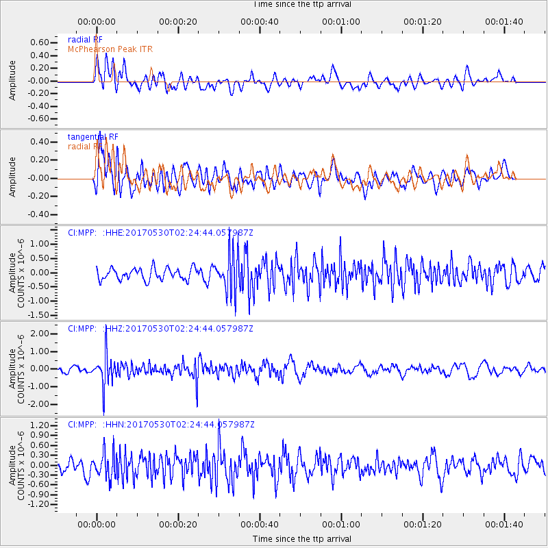
MPP McPhearson Peak - Earthquake Result Viewer
*The percent match for this event was below the threshold and hence no stack was calculated.
| Earthquake location: |
Kenai Peninsula, Alaska |
| Earthquake latitude/longitude: |
60.8/-151.8 |
| Earthquake time(UTC): |
2017/05/30 (150) 02:18:45 GMT |
| Earthquake Depth: |
78 km |
| Earthquake Magnitude: |
5.2 Mww |
| Earthquake Catalog/Contributor: |
NEIC PDE/ak |
|
| Network: |
CI Caltech Regional Seismic Network |
| Station: |
MPP McPhearson Peak |
| Lat/Lon: |
34.89 N/119.81 W |
| Elevation: |
1739 m |
|
| Distance: |
33.1 deg |
| Az: |
127.037 deg |
| Baz: |
331.602 deg |
| Ray Param: |
$rayparam |
*The percent match for this event was below the threshold and hence was not used in the summary stack. |
|
| Radial Match: |
53.442375 % |
| Radial Bump: |
400 |
| Transverse Match: |
57.51169 % |
| Transverse Bump: |
400 |
| SOD ConfigId: |
13570011 |
| Insert Time: |
2019-04-28 02:44:38.622 +0000 |
| GWidth: |
2.5 |
| Max Bumps: |
400 |
| Tol: |
0.001 |
|
Signal To Noise
| Channel | StoN | STA | LTA |
| CI:MPP: :HHZ:20170530T02:24:44.057987Z | 5.220492 | 8.658824E-7 | 1.6586222E-7 |
| CI:MPP: :HHN:20170530T02:24:44.057987Z | 1.2946794 | 3.7397393E-7 | 2.8885447E-7 |
| CI:MPP: :HHE:20170530T02:24:44.057987Z | 3.3871622 | 6.924273E-7 | 2.0442698E-7 |
| Arrivals |
| Ps | |
| PpPs | |
| PsPs/PpSs | |


