You are here: Home > Network List > LD - Lamont-Doherty Cooperative Seismographic Network Stations List
> Station GEDE Greenville, DE, USA > Earthquake Result Viewer
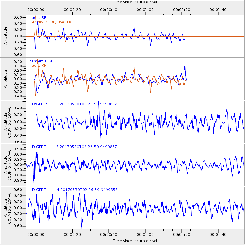
GEDE Greenville, DE, USA - Earthquake Result Viewer
*The percent match for this event was below the threshold and hence no stack was calculated.
| Earthquake location: |
Kenai Peninsula, Alaska |
| Earthquake latitude/longitude: |
60.8/-151.8 |
| Earthquake time(UTC): |
2017/05/30 (150) 02:18:45 GMT |
| Earthquake Depth: |
78 km |
| Earthquake Magnitude: |
5.2 Mww |
| Earthquake Catalog/Contributor: |
NEIC PDE/ak |
|
| Network: |
LD Lamont-Doherty Cooperative Seismographic Network |
| Station: |
GEDE Greenville, DE, USA |
| Lat/Lon: |
39.81 N/75.64 W |
| Elevation: |
105 m |
|
| Distance: |
49.8 deg |
| Az: |
78.509 deg |
| Baz: |
321.457 deg |
| Ray Param: |
$rayparam |
*The percent match for this event was below the threshold and hence was not used in the summary stack. |
|
| Radial Match: |
66.24445 % |
| Radial Bump: |
400 |
| Transverse Match: |
52.583492 % |
| Transverse Bump: |
400 |
| SOD ConfigId: |
13570011 |
| Insert Time: |
2019-04-28 02:46:52.003 +0000 |
| GWidth: |
2.5 |
| Max Bumps: |
400 |
| Tol: |
0.001 |
|
Signal To Noise
| Channel | StoN | STA | LTA |
| LD:GEDE: :HHZ:20170530T02:26:59.949985Z | 3.0465715 | 3.8815728E-7 | 1.2740789E-7 |
| LD:GEDE: :HHN:20170530T02:26:59.949985Z | 1.5767637 | 2.1694278E-7 | 1.3758738E-7 |
| LD:GEDE: :HHE:20170530T02:26:59.949985Z | 1.7313812 | 2.0095193E-7 | 1.1606453E-7 |
| Arrivals |
| Ps | |
| PpPs | |
| PsPs/PpSs | |


