You are here: Home > Network List > TA - USArray Transportable Network (new EarthScope stations) Stations List
> Station Y31A Rekieta Farm, Paducah, TX, USA > Earthquake Result Viewer
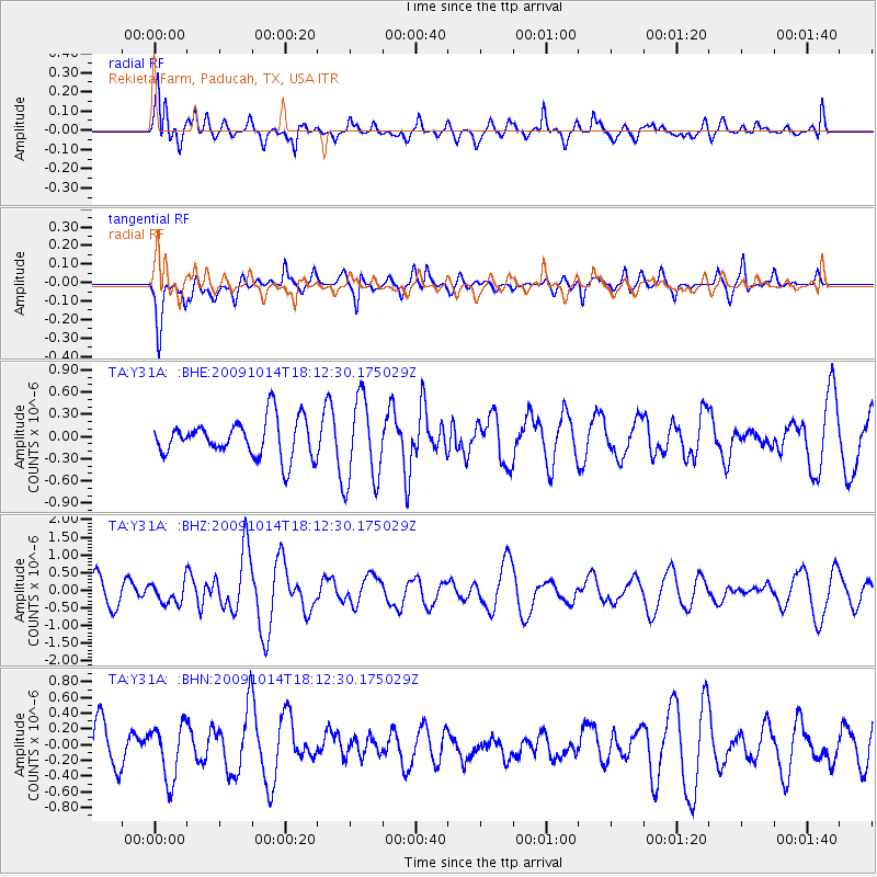
Y31A Rekieta Farm, Paducah, TX, USA - Earthquake Result Viewer
*The percent match for this event was below the threshold and hence no stack was calculated.
| Earthquake location: |
Samoa Islands Region |
| Earthquake latitude/longitude: |
-14.9/-174.8 |
| Earthquake time(UTC): |
2009/10/14 (287) 18:00:21 GMT |
| Earthquake Depth: |
10 km |
| Earthquake Magnitude: |
5.7 MB, 6.0 MS, 6.3 MW, 6.2 MW |
| Earthquake Catalog/Contributor: |
WHDF/NEIC |
|
| Network: |
TA USArray Transportable Network (new EarthScope stations) |
| Station: |
Y31A Rekieta Farm, Paducah, TX, USA |
| Lat/Lon: |
33.96 N/100.26 W |
| Elevation: |
530 m |
|
| Distance: |
85.9 deg |
| Az: |
53.438 deg |
| Baz: |
249.112 deg |
| Ray Param: |
$rayparam |
*The percent match for this event was below the threshold and hence was not used in the summary stack. |
|
| Radial Match: |
64.061226 % |
| Radial Bump: |
400 |
| Transverse Match: |
54.849003 % |
| Transverse Bump: |
400 |
| SOD ConfigId: |
2622 |
| Insert Time: |
2010-03-06 00:13:48.586 +0000 |
| GWidth: |
2.5 |
| Max Bumps: |
400 |
| Tol: |
0.001 |
|
Signal To Noise
| Channel | StoN | STA | LTA |
| TA:Y31A: :BHZ:20091014T18:12:30.175029Z | 0.86681587 | 2.9426656E-7 | 3.394799E-7 |
| TA:Y31A: :BHN:20091014T18:12:30.175029Z | 1.2282581 | 3.4059354E-7 | 2.77298E-7 |
| TA:Y31A: :BHE:20091014T18:12:30.175029Z | 2.2933757 | 5.726508E-7 | 2.4969776E-7 |
| Arrivals |
| Ps | |
| PpPs | |
| PsPs/PpSs | |


