You are here: Home > Network List > UU - University of Utah Regional Network Stations List
> Station CCUT Cedar City, UT, USA > Earthquake Result Viewer
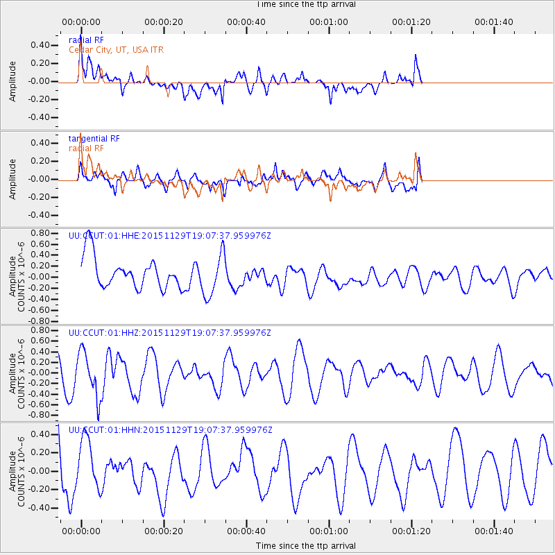
CCUT Cedar City, UT, USA - Earthquake Result Viewer
*The percent match for this event was below the threshold and hence no stack was calculated.
| Earthquake location: |
Jujuy Province, Argentina |
| Earthquake latitude/longitude: |
-23.5/-64.6 |
| Earthquake time(UTC): |
2015/11/29 (333) 18:56:21 GMT |
| Earthquake Depth: |
10 km |
| Earthquake Magnitude: |
5.5 MB |
| Earthquake Catalog/Contributor: |
NEIC PDE/NEIC COMCAT |
|
| Network: |
UU University of Utah Regional Network |
| Station: |
CCUT Cedar City, UT, USA |
| Lat/Lon: |
37.55 N/113.36 W |
| Elevation: |
2127 m |
|
| Distance: |
76.1 deg |
| Az: |
321.983 deg |
| Baz: |
134.642 deg |
| Ray Param: |
$rayparam |
*The percent match for this event was below the threshold and hence was not used in the summary stack. |
|
| Radial Match: |
59.581924 % |
| Radial Bump: |
400 |
| Transverse Match: |
34.53082 % |
| Transverse Bump: |
400 |
| SOD ConfigId: |
1259291 |
| Insert Time: |
2015-12-27 16:16:32.663 +0000 |
| GWidth: |
2.5 |
| Max Bumps: |
400 |
| Tol: |
0.001 |
|
Signal To Noise
| Channel | StoN | STA | LTA |
| UU:CCUT:01:HHZ:20151129T19:07:37.959976Z | 1.1570829 | 4.312421E-7 | 3.7269768E-7 |
| UU:CCUT:01:HHN:20151129T19:07:37.959976Z | 0.9158827 | 2.9541113E-7 | 3.2254252E-7 |
| UU:CCUT:01:HHE:20151129T19:07:37.959976Z | 1.3921471 | 3.9029794E-7 | 2.8035683E-7 |
| Arrivals |
| Ps | |
| PpPs | |
| PsPs/PpSs | |


