You are here: Home > Network List > TA - USArray Transportable Network (new EarthScope stations) Stations List
> Station BGNE Belgrade, NE, USA > Earthquake Result Viewer
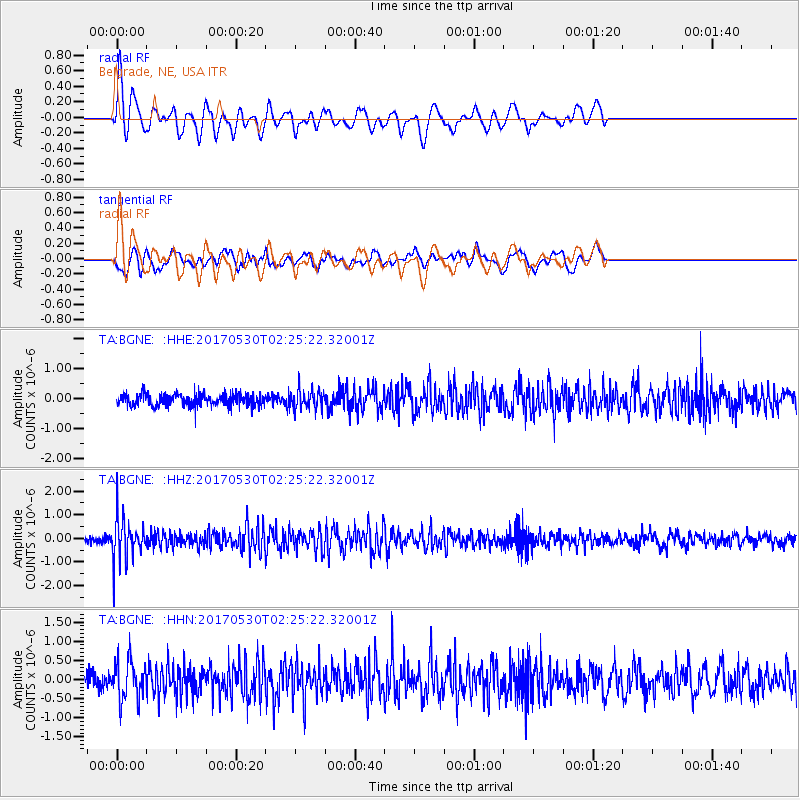
BGNE Belgrade, NE, USA - Earthquake Result Viewer
*The percent match for this event was below the threshold and hence no stack was calculated.
| Earthquake location: |
Kenai Peninsula, Alaska |
| Earthquake latitude/longitude: |
60.8/-151.8 |
| Earthquake time(UTC): |
2017/05/30 (150) 02:18:45 GMT |
| Earthquake Depth: |
78 km |
| Earthquake Magnitude: |
5.2 Mww |
| Earthquake Catalog/Contributor: |
NEIC PDE/ak |
|
| Network: |
TA USArray Transportable Network (new EarthScope stations) |
| Station: |
BGNE Belgrade, NE, USA |
| Lat/Lon: |
41.41 N/98.15 W |
| Elevation: |
573 m |
|
| Distance: |
37.6 deg |
| Az: |
96.191 deg |
| Baz: |
319.66 deg |
| Ray Param: |
$rayparam |
*The percent match for this event was below the threshold and hence was not used in the summary stack. |
|
| Radial Match: |
64.9611 % |
| Radial Bump: |
383 |
| Transverse Match: |
50.619385 % |
| Transverse Bump: |
400 |
| SOD ConfigId: |
13570011 |
| Insert Time: |
2019-04-28 02:50:39.888 +0000 |
| GWidth: |
2.5 |
| Max Bumps: |
400 |
| Tol: |
0.001 |
|
Signal To Noise
| Channel | StoN | STA | LTA |
| TA:BGNE: :HHZ:20170530T02:25:22.32001Z | 5.613185 | 8.9883827E-7 | 1.6012982E-7 |
| TA:BGNE: :HHN:20170530T02:25:22.32001Z | 2.0169053 | 5.0966656E-7 | 2.526973E-7 |
| TA:BGNE: :HHE:20170530T02:25:22.32001Z | 1.6435986 | 3.2213046E-7 | 1.9599095E-7 |
| Arrivals |
| Ps | |
| PpPs | |
| PsPs/PpSs | |


