You are here: Home > Network List > TA - USArray Transportable Network (new EarthScope stations) Stations List
> Station Q24A Divide, CO, USA > Earthquake Result Viewer
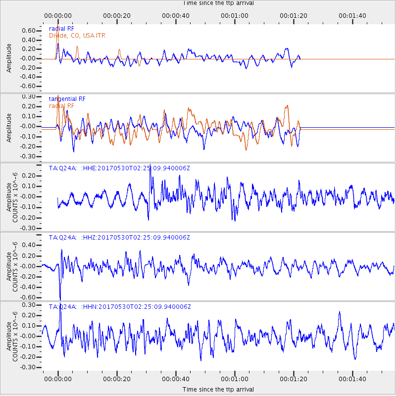
Q24A Divide, CO, USA - Earthquake Result Viewer
*The percent match for this event was below the threshold and hence no stack was calculated.
| Earthquake location: |
Kenai Peninsula, Alaska |
| Earthquake latitude/longitude: |
60.8/-151.8 |
| Earthquake time(UTC): |
2017/05/30 (150) 02:18:45 GMT |
| Earthquake Depth: |
78 km |
| Earthquake Magnitude: |
5.2 Mww |
| Earthquake Catalog/Contributor: |
NEIC PDE/ak |
|
| Network: |
TA USArray Transportable Network (new EarthScope stations) |
| Station: |
Q24A Divide, CO, USA |
| Lat/Lon: |
38.96 N/105.15 W |
| Elevation: |
2775 m |
|
| Distance: |
36.1 deg |
| Az: |
105.716 deg |
| Baz: |
322.789 deg |
| Ray Param: |
$rayparam |
*The percent match for this event was below the threshold and hence was not used in the summary stack. |
|
| Radial Match: |
57.217545 % |
| Radial Bump: |
400 |
| Transverse Match: |
60.33665 % |
| Transverse Bump: |
400 |
| SOD ConfigId: |
13570011 |
| Insert Time: |
2019-04-28 02:50:50.531 +0000 |
| GWidth: |
2.5 |
| Max Bumps: |
400 |
| Tol: |
0.001 |
|
Signal To Noise
| Channel | StoN | STA | LTA |
| TA:Q24A: :HHZ:20170530T02:25:09.940006Z | 2.9535897 | 1.9037438E-7 | 6.445526E-8 |
| TA:Q24A: :HHN:20170530T02:25:09.940006Z | 2.985388 | 1.12004784E-7 | 3.7517665E-8 |
| TA:Q24A: :HHE:20170530T02:25:09.940006Z | 2.267537 | 1.1700137E-7 | 5.1598438E-8 |
| Arrivals |
| Ps | |
| PpPs | |
| PsPs/PpSs | |


