You are here: Home > Network List > TA - USArray Transportable Network (new EarthScope stations) Stations List
> Station TPFO Pinon Flats, CA, USA > Earthquake Result Viewer
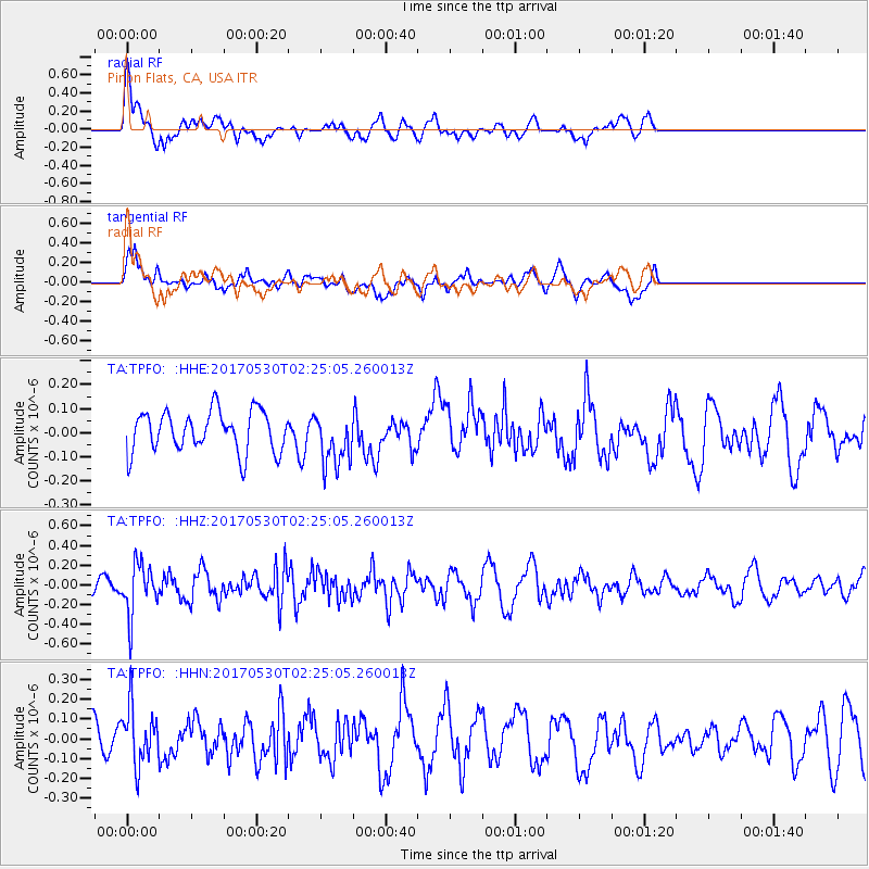
TPFO Pinon Flats, CA, USA - Earthquake Result Viewer
*The percent match for this event was below the threshold and hence no stack was calculated.
| Earthquake location: |
Kenai Peninsula, Alaska |
| Earthquake latitude/longitude: |
60.8/-151.8 |
| Earthquake time(UTC): |
2017/05/30 (150) 02:18:45 GMT |
| Earthquake Depth: |
78 km |
| Earthquake Magnitude: |
5.2 Mww |
| Earthquake Catalog/Contributor: |
NEIC PDE/ak |
|
| Network: |
TA USArray Transportable Network (new EarthScope stations) |
| Station: |
TPFO Pinon Flats, CA, USA |
| Lat/Lon: |
33.61 N/116.45 W |
| Elevation: |
1275 m |
|
| Distance: |
35.6 deg |
| Az: |
123.804 deg |
| Baz: |
330.814 deg |
| Ray Param: |
$rayparam |
*The percent match for this event was below the threshold and hence was not used in the summary stack. |
|
| Radial Match: |
62.621414 % |
| Radial Bump: |
400 |
| Transverse Match: |
60.196518 % |
| Transverse Bump: |
400 |
| SOD ConfigId: |
13570011 |
| Insert Time: |
2019-04-28 02:50:56.144 +0000 |
| GWidth: |
2.5 |
| Max Bumps: |
400 |
| Tol: |
0.001 |
|
Signal To Noise
| Channel | StoN | STA | LTA |
| TA:TPFO: :HHZ:20170530T02:25:05.260013Z | 2.4679515 | 2.5479486E-7 | 1.0324143E-7 |
| TA:TPFO: :HHN:20170530T02:25:05.260013Z | 0.9851022 | 1.4097812E-7 | 1.4311014E-7 |
| TA:TPFO: :HHE:20170530T02:25:05.260013Z | 1.2925856 | 1.0947302E-7 | 8.4693056E-8 |
| Arrivals |
| Ps | |
| PpPs | |
| PsPs/PpSs | |


