You are here: Home > Network List > TJ - Tajikistan National Seismic Network Stations List
> Station GARM Garm, Tajikistan > Earthquake Result Viewer
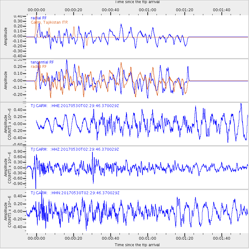
GARM Garm, Tajikistan - Earthquake Result Viewer
*The percent match for this event was below the threshold and hence no stack was calculated.
| Earthquake location: |
Kenai Peninsula, Alaska |
| Earthquake latitude/longitude: |
60.8/-151.8 |
| Earthquake time(UTC): |
2017/05/30 (150) 02:18:45 GMT |
| Earthquake Depth: |
78 km |
| Earthquake Magnitude: |
5.2 Mww |
| Earthquake Catalog/Contributor: |
NEIC PDE/ak |
|
| Network: |
TJ Tajikistan National Seismic Network |
| Station: |
GARM Garm, Tajikistan |
| Lat/Lon: |
39.00 N/70.32 E |
| Elevation: |
1305 m |
|
| Distance: |
74.7 deg |
| Az: |
327.181 deg |
| Baz: |
19.918 deg |
| Ray Param: |
$rayparam |
*The percent match for this event was below the threshold and hence was not used in the summary stack. |
|
| Radial Match: |
53.28417 % |
| Radial Bump: |
396 |
| Transverse Match: |
51.88107 % |
| Transverse Bump: |
369 |
| SOD ConfigId: |
13570011 |
| Insert Time: |
2019-04-28 02:51:06.749 +0000 |
| GWidth: |
2.5 |
| Max Bumps: |
400 |
| Tol: |
0.001 |
|
Signal To Noise
| Channel | StoN | STA | LTA |
| TJ:GARM: :HHZ:20170530T02:29:46.370029Z | 3.9024534 | 3.6308973E-7 | 9.30414E-8 |
| TJ:GARM: :HHN:20170530T02:29:46.370029Z | 1.2186582 | 1.7568556E-7 | 1.4416311E-7 |
| TJ:GARM: :HHE:20170530T02:29:46.370029Z | 1.2483835 | 1.8421613E-7 | 1.4756374E-7 |
| Arrivals |
| Ps | |
| PpPs | |
| PsPs/PpSs | |


