You are here: Home > Network List > AV - Alaska Volcano Observatory Stations List
> Station AMKA Regional Station, Amchitka Island, Alaska > Earthquake Result Viewer
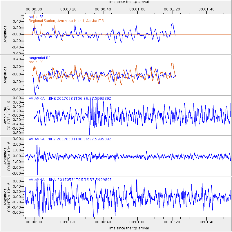
AMKA Regional Station, Amchitka Island, Alaska - Earthquake Result Viewer
*The percent match for this event was below the threshold and hence no stack was calculated.
| Earthquake location: |
Mariana Islands |
| Earthquake latitude/longitude: |
19.1/145.9 |
| Earthquake time(UTC): |
2017/05/31 (151) 06:29:32 GMT |
| Earthquake Depth: |
121 km |
| Earthquake Magnitude: |
5.4 Mww |
| Earthquake Catalog/Contributor: |
NEIC PDE/us |
|
| Network: |
AV Alaska Volcano Observatory |
| Station: |
AMKA Regional Station, Amchitka Island, Alaska |
| Lat/Lon: |
51.38 N/179.30 E |
| Elevation: |
116 m |
|
| Distance: |
41.6 deg |
| Az: |
31.359 deg |
| Baz: |
231.739 deg |
| Ray Param: |
$rayparam |
*The percent match for this event was below the threshold and hence was not used in the summary stack. |
|
| Radial Match: |
59.612442 % |
| Radial Bump: |
400 |
| Transverse Match: |
51.53393 % |
| Transverse Bump: |
400 |
| SOD ConfigId: |
13570011 |
| Insert Time: |
2019-04-28 02:56:13.434 +0000 |
| GWidth: |
2.5 |
| Max Bumps: |
400 |
| Tol: |
0.001 |
|
Signal To Noise
| Channel | StoN | STA | LTA |
| AV:AMKA: :BHZ:20170531T06:36:37.599989Z | 3.845048 | 9.309193E-7 | 2.4210863E-7 |
| AV:AMKA: :BHN:20170531T06:36:37.599989Z | 1.7035688 | 3.5824112E-7 | 2.102886E-7 |
| AV:AMKA: :BHE:20170531T06:36:37.599989Z | 1.6403214 | 3.306011E-7 | 2.0154654E-7 |
| Arrivals |
| Ps | |
| PpPs | |
| PsPs/PpSs | |


